Riddlesdown to Coulsdon South Walk
Happy Valley and Farthing Down, close to London (Zone 6)

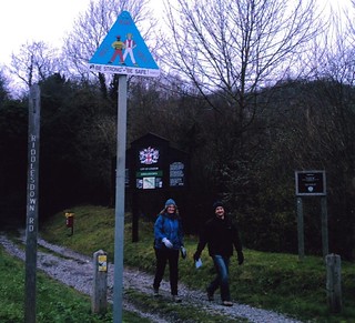
walk_15_pc_Sunlight_on_Coulsdon_Common
Dec-04 • Peter Conway on Flickr
swcwalks book2 walk15 36487165554

Book 2, Walk 15b, Riddlesdown to Coulsdon South
The Route. Opposite where the recently demolished Rose & Crown stood. D.Allen Vivitar 5199mp
Jan-06 • magyardave2002 on Flickr
south coulsdon book2 walk15 riddlesdown swcwalks walk15b 2172842415

Map of Happy Valley and Farthing Down
Mar-07 • Andrew Murphy on Flickr
coulsdon book2 walk15 swcwalks 432676169


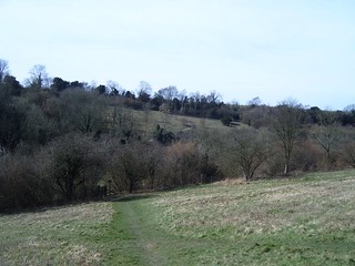
Coulsdon Common, Happy Valley and Farthing Downs
| Length |
Standard Walk: 16.8km (10.4 miles), five hours walking time. For the whole excursion including trains and meals allow 7 hours. Shortening the walk: By using the short cut to Chaldon Church at the point indicated in the text 1.7km after the Fox pub (at point [4]), you can cut 4.3km off either the main walk, or the option below. Alternative circular walk from Coulsdon South: By starting at Coulsdon South, you can make the walk slightly shorter to 14.2km (8.8 miles). Trains to Coulsdon South go from Victoria and London Bridge, with a similar journey time. |
|---|---|
| Maps |
OS Landranger 187 OS Explorer 146 (and 161 for part of Riddlesdown start). |
| Toughness |
4 out of 10 |
| Features |
Considering that it starts in the suburbs of London (and within the boundaries of London Transport Travelcard zone six), this walk passes through some remarkably unspoilt countryside. Farthing Down, Kenley Common, Riddlesdown and Cousldon Commons are all ancient grazing lands, lovingly preserved as part of the London Greenbelt, and offering a delightful series of woods and open spaces. In spring the area is famous for wild flowers, including several bluebell woods, while in autumn it is a riot of golden colour. This is also a fine walk for a brisk winter's day, and in summer offers numerous idyllic spots for a picnic. In the current (2011) edition, this walk starts from Riddlesdown, with starting from Coulsdon South an option - in the older versions, it was the other way round. |
| Walk Options |
15A Shorter WalkBy using the short cut to Chaldon Church at the point indicated in the text 1.7km after the Fox pub, you can cut 4.3km (2.6 miles) off either of the two main walks. If you want to finish the walk at the Fox pub, there is a regular 466 bus service from the end of Fox Lane to East Croydon Station (journey time: 25 mins; Tel 020 8673 6109 for timetable information) with frequent trains into London. Alternatively bus 404 also goes hourly from Monday to Saturday from the end of Fox Lane to Coulsdon South Station till 7pm. Tel 020 7222 1234 for exact times. From point [5] in the text, you can take bus 540 on Mondays to Fridays to Caterham or Merstham stations. Both these stations are out of zone six, however. For details call North Downs Motor Services on 020 8640 6668 or Skinners of Oxted on 01883 713 633 15B Coulsdon South CircularThis walk joins the main walk at the Fox (lunch pub). Note: those with older 2004 and 2006 editions of the books should use the updated version in the main walk pdf 15C Finish in Kingswood OptionThese directions provide a longer walk with a new after lunch route, ending in Kingswood, making a linear walk from Riddlesdown to Kingswood |
| History |
England was once covered with commons - common grazing lands for a particular village. Many were lost to private landowners in the Enclosure movement in the 18th century, and others have reverted to woodland for lack of management or become farmland. The preservation of Farthing Down, Kenley Common, Coulsdon Common and Riddlesdown on this walk is due to the forward thinking of the Corporation of London (the local authority for the City of London), who in the 1880s started to acquire land in and around London to promote good health and give Londoners a place of recreation. These particular commons were purchased in 1883, and the decision was a popular one. In the 1900s thousands of day trippers would come to picnic on the commons on summer weekends, and visit Gardner's fairground on Riddlesdown. All four commons are particularly rich in wild flowers in spring, and are the habitat for many birds and insects. The Corporation still owns some 10,000 acres of land, which is all managed for the public good at no cost to the taxpayer Happy Valley is different from the other commons in that it was only turned into an open space in 1937 and 1938, when various local farms were bought by Coulsdon Council as part of the London Greenbelt scheme, which sought to limit the spread of London by preserving a ring of open countryside around the city. It is a Site of Special Scientific Interest for its flora and as a habitat for ground nesting birds such as larks. Chaldon Church has a wall painting dating back to the Middle Ages. |
| Travel |
Take the train nearest to 10.15am from London Victoria to Riddlesdown. Journey time 24 minutes. This journey is covered by a London Transport zone six travelcard. Otherwise a day return to either Coulsdon South or Riddlesdown will probably be acceptable, though the two routes actually diverge south of East Croydon . For the Coulsdon South start, take the train nearest to 10.45am from Victoria or London Bridge. Journey time here is about 30 minutes. This journey is also covered by an Tfl zone six travelcard. Otherwise a day return to Coulsdon South. |
| By car |
This is one walk which really is better reached by public transport. Coulsdon South is easily and quickly reached from Central London by train, and there are direct trains also from Redhill, Gatwick, Crawley and Horsham. By contrast, the small car park at Coulsdon South station is for season ticket holders only, and the area around the station is not otherwise parking-friendly: even the residential streets on the east side of the stations have parking restrictions from Monday to Friday, and are mainly reserved for residents parking at weekends. It is slightly easier to park at Riddlesdown, but to get back to it from Coulsdon South involves travelling up to East Croydon and changing. There is no direct bus route between Coulsdon South and Riddlesdown. The best option for drivers is the Coulsdon South Circular (park near the lunch pub) or Coulsdon South (start option) to Riddlesdown (finish option), and catch a train back to nearby Coulsdon Town station. |
| Lunch |
The Fox pub (tel 01883 330401) on Coulsdon Common serves food all day from noon and has a large seating capacity both inside and in the garden. Family menu. It is 3.7km (2.3 miles) into the walk if starting at Coulsdon South, and 6.2km (3.9 miles) from Riddlesdown. If starting from Riddlesdown, a slightly earlier alternative is the Wattenden Arms, just past Kenley Common. Smaller than the Fox, but with a certain cosy charm, this serves a moderately inventive menu from 12pm to 2.30pm Monday to Saturday and 12pm to 3pm on Sunday. Picnic spots are not hard to find on this walk, with each of the commons offering several charming spots, and often strategically placed benches. |
| Tea |
Tea options are somewhat limited: this is perhaps a good walk to bring a thermos flask, as Farthing Down and Happy Valley both have benches with fine views for a picnic tea. Otherwise, in Farthing Down car park there is sometimes a refreshment trailer at weekends and on fine summer days. Alternatively try the Poppy Café in the Coulsdon Memorial Ground which is opposite Reddown Road and a five minute walk to Coulsdon South station. About 5 mins walk after Coulsdon South station is Coulsdon town centre which has a pub. At the very end of the walk, instead of turning left on Reddown road (a side street) for the station, continue downhill, under the bridges to the roundabout. Cross it and continue (now Brighton Road), bear right after 25 metres (still Brighton Road) on a quiet shopping street. After 200 metres, you reach a small roundabout. This is the town centre, the pub is to your left. |
| Book |
This walk was originally published in Time Out Country Walks near London volume 2. We now recommend using this online version as the book is dated. |
|---|---|
| Profile | |
| Help Us! |
After the walk, please leave a comment, it really helps. Thanks! You can also upload photos to the SWC Group on Flickr (upload your photos) and videos to Youtube. This walk's tags are: |
| By Train |
Out (not a train station) Back (not a train station) |
| By Car |
Start Map Directions Return to the start: Finish Map Directions Travel to the start: |
| Amazon | |
| Help |
National Rail: 03457 48 49 50 • Traveline (bus times): 0871 200 22 33 (12p/min) • TFL (London) : 0343 222 1234 |
| Version |
Jul-23 DAC |
| Copyright | © Saturday Walkers Club. All Rights Reserved. No commercial use. No copying. No derivatives. Free with attribution for one time non-commercial use only. www.walkingclub.org.uk/site/license.shtml |
Walk Directions
Full directions for this walk are in a PDF file (link above) which you can print, or download on to a Kindle, tablet, or smartphone.
This is just the introduction. This walk's detailed directions are in a PDF available from wwww.walkingclub.org.uk


