Tadworth via Headley Heath and Box Hill Circular Walk
Mixed open and wooded chalk downland with several viewpoints close to London

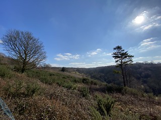
View towards Mickleham, Juniper Top
SWC Walk 139 Tadworth Circular via Headley Heath and Box Hill
Feb-21 • thomasgrabow on Flickr
swcwalks swcwalk139 banner 50993489722

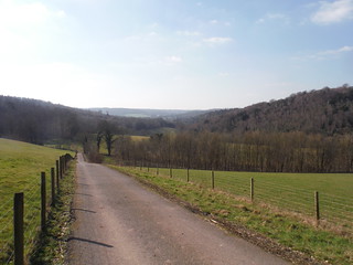
Ebbisham Farm Paddocks
SWC Walk 139 Tadworth Circular via Headley Heath and Box Hill
Feb-21 • thomasgrabow on Flickr
swcwalks swcwalk139 walkicon 50992680818

St. Mary's, Headley (Surrey)
SWC Walk 139 Tadworth Circular via Headley Heath and Box Hill
Feb-21 • thomasgrabow on Flickr
swcwalks swcwalk139 walkicon 50993492452

Valley in Headley Heath
SWC Walk 139 Tadworth Circular via Headley Heath and Box Hill
Feb-21 • thomasgrabow on Flickr
swcwalks swcwalk139 walkicon 50993377171

View from Junipers downvalley towards Mole Valley
SWC Walk 139 Tadworth Circular via Headley Heath and Box Hill
Feb-21 • thomasgrabow on Flickr
swcwalks swcwalk139 walkicon 50993376261
| Length | 19.5 km / 12.1 mi |
|---|---|
| Toughness | 6 out of 10 (460m of ascent). Mainly gentle inclines over well drained paths, but several ups and downs on Headley Heath and Box Hill. |
| Maps | OS Explorer 146 (Dorking) |
| Features |
This walk over the National Trust's picturesque Headley Heath ("open heathland, woodland, and chalk downland") to Box Hill (also NT, noted viewpoint) feels very remote even though it starts within London Zone 6. The main walk returns via Headley Heath, the more strenuous longer option follows the North Downs Way, with views to the south. Drivers can park on the Heath, cutting out the walks to and from the station The walk starts at Tadworth (Zone 6), just south of Epsom Downs, and crosses open downland (and under the M25) to Headley (early lunch pub). At the start of Headley Heath, there are a couple of NT car parks. The main part of the walk crosses the open heathland - with a mix of partly forested hills allowing nice views for most of the way. There is an option to visit White Hill (recommended, a steep climb) with unexpectedly fine views (also visited on the Box Hill Circular Walk). Both routes join to head south onto Juniper Top (more views), before following a forest track to the Box Hill viewpoint (NT cafe, car park), a perfect (if often crowded) picnic spot. Then it's a gentle stretch along the North Downs Way (NDW) along the edge of the escarpment, followed by either short stretch along a road (or strenuous stretch of the NDW) to the late lunch pub. After lunch you have a choice. The main walk returns across pretty Headley Heath along gentle forested paths, or there is a longer and much more strenuous NDW escarpment option with a gentle Walton Heath ending. Both routes join up with a choice of 2 pubs for tea about 20 mins walk before the station A compass (or GPS) is recommended on this walk - it's easy to loose your sense of direction on the heathland. |
| Walk Options |
|
| Travel |
Tadworth is in London Travelcard Zone 6. 2 trains an hour (46 mins) from London Bridge or from Victoria changing at East Croydon. Headley Heath car park x 2 (NT) - KT18 6NN - £5 per day (free for NT members) - no cash - online or phone only. The small car parks on Mill Lane and Headley Lane are still free. There is a TFL bus stop in Mickleham (off route, near White Hill) on a Kingston - Surbiton - Chessington - Dorking route which takes Oyster/Contactless |
| Points of Interest |
|
| Author's Note |
The aim of this walk is to visit the very picturesque Headley Heath, and start from a station within Zone 6! While White Hill, Juniper Top and Box Hill are worthy destinations, simply exploring Headley Heath is also recommended. Do take a compass - its easy to loose your orientation as there are many paths and few landmarks. Its a shame that Box Hill and Headley Heath (both NT) are separated by High Ashurst - a fenced off Outdoor Centre owned by Surrey Council - this limited route options in designing this walk. |
| Lunch and Tea |
Covid: checked Mar-22 |
| Profile | |
|---|---|
| Help Us! |
After the walk, please leave a comment, it really helps. Thanks! You can also upload photos to the SWC Group on Flickr (upload your photos) and videos to Youtube. This walk's tags are: |
| By Train | |
| By Car |
Start Map Directions |
| Map Walk | This walk requires an OS map and a compass or GPS for navigation. You can print out OS maps using the link above. |
| Amazon | |
| Help |
National Rail: 03457 48 49 50 • Traveline (bus times): 0871 200 22 33 (12p/min) • TFL (London) : 0343 222 1234 |
| Version |
Mar-21 Andrew |
| Copyright | © Saturday Walkers Club. All Rights Reserved. No commercial use. No copying. No derivatives. Free with attribution for one time non-commercial use only. www.walkingclub.org.uk/site/license.shtml |
Walk Directions
Full directions for this walk are in a PDF file (link above) which you can print, or download on to a Kindle, tablet, or smartphone.
This is just the introduction. This walk's detailed directions are in a PDF available from wwww.walkingclub.org.uk
