Cheddington to Leighton Buzzard Walk
Delightful hill top villages in East Bucks. Panoramic views of The Chilterns and into Aylesbury Vale.
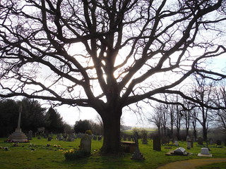
Tree in Churchyard, All Saints, Wing
SWC Walk Cheddington to Leighton Buzzard
Mar-16 • thomasgrabow on Flickr
swcwalks swcwalk195 banner walkicon 25470495212
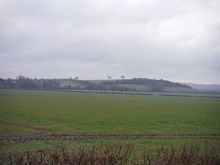
Westend Hill, Cheddington from footpath by the Golf Club
SWC Walk Cheddington to Leighton Buzzard
Mar-16 • thomasgrabow on Flickr
walkicon swcwalks swcwalk195 25589302985
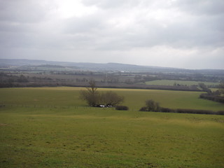
Chiltern View from field at Helsthorpe Farm
SWC Walk Cheddington to Leighton Buzzard
Mar-16 • thomasgrabow on Flickr
walkicon swcwalks swcwalk195 25221730029
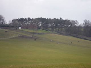
Farm near Aston Abbotts
SWC Walk Cheddington to Leighton Buzzard
Mar-16 • thomasgrabow on Flickr
walkicon swcwalks swcwalk195 25589193415
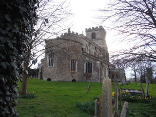
All Saints Church, Wing, with its rare octagonal apse
SWC Walk Cheddington to Leighton Buzzard
Mar-16 • thomasgrabow on Flickr
walkicon swcwalks swcwalk195 25221538169
| Length |
24.8 km (15.4 mi), with 240/247m ascent/descent. For a shorter walk see below Walk Options. |
|---|---|
| Toughness |
4 out of 10, with 5 hours 30 minutes walking time. For the whole outing, including trains, sights and meals, allow at least 7 hours and 45 minutes. |
| Walk Notes |
A splendid walk through East Buckinghamshire’s rolling landscape of fields and wooded areas on the edge of the Chiltern Hills, linking up a handful of delightful hill top villages to provide panoramic views across pleasant countryside. Broadly following the Thames/Great Ouse watershed in the morning, it initially heads west, mostly with grand views of the Chilterns (when not walking in wooded areas), to then turn north with far views into Aylesbury Vale to the west, on to lunch pubs at either Aston Abbotts or Cublington.
Disclaimers: There are several arable field crossings to contend with, generally along well-cleared paths, but this walk is nevertheless more challenging in high summer. There is also a level crossing of the dual carriageway Leighton Buzzard-bypass road near the end of the walk. |
| Walk Options |
Bus services linking Aylesbury with Leighton Buzzard run through the walk area, but the walk can sensibly only be shortened by taking a bus to Leighton Buzzard, as Aylesbury is being served by a different train company, necessitating the extra cost of two single tickets:
|
| Maps |
OS Explorer: 181 (Chiltern Hills North) and 192 (Buckingham & Milton Keynes)
|
| Travel |
Cheddington station, map reference SP 922 185, is 11 km north east of Aylesbury, 6 km south of Leighton Buzzard, 99m above sea level and in Buckinghamshire. Leighton Buzzard Station, map reference SP 910 249, is in Linslade, which lies west of the River Ouzel, while Leighton Buzzard itself lies east of it. It is 15 km north east of Aylesbury, 15 km south east of Milton Keynes, 92m above sea level and in Bedfordshire. Cheddington and Leighton Buzzard stations are on the London Euston to Milton Keynes (West Coast) Main Line. Journey times are from 36 minutes to Cheddington (hourly service) and between 31 and 60 minutes from Leighton Buzzard (up to 3 trains per hour). Buy a day return to Leighton Buzzard. Saturday Walkers’ Club: Take the train closest to 9.30 hours. |
| Lunch |
The Rose & Crown The Green, Dark Lane, Wingrave, Buckinghamshire, HP22 4PD (01296 708 414). The Rose & Crown is located 7.0 km (4.4 mi) into the walk.
|
| Tea |
Various options in Wing (5 km from the end of the walk), in Linslade (near Leighton Buzzard station) and in the centre of Leighton Buzzard. For details see page 2 of the Walk Directions pdf. |
| Profile | |
|---|---|
| Help Us! |
After the walk, please leave a comment, it really helps. Thanks! You can also upload photos to the SWC Group on Flickr (upload your photos) and videos to Youtube. This walk's tags are: |
| By Train |
Out (not a train station) Back (not a train station) |
| By Car |
Start Map Directions Return to the start: Finish Map Directions Travel to the start: |
| Amazon | |
| Help |
National Rail: 03457 48 49 50 • Traveline (bus times): 0871 200 22 33 (12p/min) • TFL (London) : 0343 222 1234 |
| Version |
Jul-21 Thomas G |
| Copyright | © Saturday Walkers Club. All Rights Reserved. No commercial use. No copying. No derivatives. Free with attribution for one time non-commercial use only. www.walkingclub.org.uk/site/license.shtml |

Walk Directions
Full directions for this walk are in a PDF file (link above) which you can print, or download on to a Kindle, tablet, or smartphone.
This is just the introduction. This walk's detailed directions are in a PDF available from wwww.walkingclub.org.uk