Black Mountains Ridge walk
Spectacular mountain ridge walk - Hay Bluff, Lord Hereford's Knob, & Waun Fach. Tough, with shorter easier options. Car only.
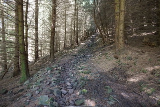
Ascending from Myndd Du car park in the Grwyne Fawr valley
swcwalks swcwalk339 52108559500
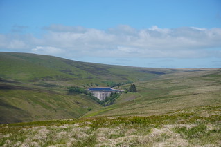

Ascending from the Vale of Ewyas to the "Offer's Dyke" path
swcwalks swcwalk339 52108301444

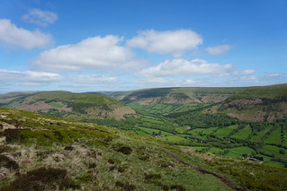
Ascending from the Vale of Ewyas to the "Offer's Dyke" path
swcwalks swcwalk339 52108564260

| Length |
Main Walk: 15.5 miles (24.9 km) with 3,550 feet (1,075 m) of elevation Vale of Ewyas circular (east) : ~15km with ~540m ascent Grwyne Fawr circular (west) : ~13km with ~490m ascent Out-and back walks from Gospel Pass at 550m elevation
|
|---|---|
| Toughness |
10 / 10 for the main walk 8 / 10 for the 2 shorther circular day walks 3 / 10 for the Gospel Pass East short walk, or 5 / 10 for the Gospel Pass west short walk (boggy terrain). Apart from the maintained "Offer's Dyke" path, the ridge top paths are eroded in places, and wet/boggy even in dry weather. The lower paths are better. |
| Walk Notes |
This is a spectacular ridge walk along the main Black Mountains peaks - the "Offer's Dyke" path / Hatterrall ridge ( 637m ), Hay Bluff ( 677m ), (Gospel Pass), Lord Hereford's Knob ( 690m ), & Waun Fach ( 811m ). The catch is that its an 'E' shaped mountain, i.e. 2 adjoining 'U' shaped valleys, so you have 2 steep climbs and descents to do, not just one! As this makes for a long strenuous day, too long for many, some shorter walks are suggested. The walk starts at a remote National Park car park, Myndd Du (Black Mountain in Welsh) at 1,300 feet, and climbs over a ridge (+250m, the middle of the 'E') to the neighbouring Ewyas valley at Capel-y-ffin (remote hamlet) at 1,000 feet. Here, the steep climb up to the "Offer's Dyke" path ridge starts (+320 m). Once up on the ridge, the remainder of the walk follows it in a long semi circle. The ridge itself is open moorland. The "Offer's Dyke" section of the ridge forms the England Wales border. The path is well maintained, with steps across the wetter bits. After a a gentle walk north to Hay Buff, 677m (+80m via the highest point), the ridge turns west, and descends to Gospel Pass (549m), the highest road in Wales, and possible starting point. The ridge continues west over open moorland, and the path is eroded in places, wet even on dry days. Lord Hereford's Knob (690m, +140m)is close by, but after a short descent, its a long walk along the ridge gently ascending to Waun Fach (811m, +200m). From here, its a steep descent down to the Myndd Du car park. Note this is the Black Mountains (plural) mountain range, at the eastern end of the Brecon Beacons National Park, which contains a top called Black Mountain (singular) / Twyn Lech. There is also a mountain range called Black Mountain (singular) at the western end of the national park. |
| Walk Options |
Split the walk in 2, and do 2 shorter day walks around the 2 adjoining 'U' shaped valleys, with just 1 steep ascent.
Much easier linear short walks starting from Gospel Pass, the highest road in Wales, at 549m (1,801 ft!).
|
| Safety |
This is a very long remote walk over very exposed open moorland. The ony road access / escape route is at Gospel Pass. Check the weather before leaving home! Let someone know you are going! Take a survival bag, spare batteries and don't rely on your phone alone for navigation. |
| Travel |
Vale of Ewyas. The single track with passing places valley road runs from Hay-on-Wye in the north, via Capel-y-ffin and Llanthony (pub, ruined medieval priory) to the A465 (and Abergavenny) in the south.. Note: both places are in the same postcode - navigate by name instead when nearby
Grwyne Fawr valley
This walk can't be done by public transport. Hay-on-Wye (coach/bus only, no train station) in the north is too far from Gospel Pass to walk in, you'd have to take a taxi. From the south its 10 miles from Abergavenny station to Myndd Du car park, or 15 miles to Capel-y-ffin hamlet. |
| Eat |
Nothing on the walk. There is a hotel/pub in Llanthony, on the Vale of Ewyas valley road. |
| Stay |
There is a very small (max 3) mountain bothy, the southern most in the UK, at Grwyne Fawr, just north of the reservoir. Capel-y-Ffin Monastery is actually reasonably priced self-catering accomodation (rather than a ruined monastery). Abergavenny has a Premmier Inn, backpackers, and campsite. Hay-on-Wye has many places. |
| Welsh Glossary |
aber: estuary, confluence, river mouth; afon: river; affwys: abyss; allt: hillside, cliff; aran: high place; ban/fan/bannau (pl): peak/beacon/crest, hill/mountain; big: peak; blaen: source of river, head of valley; bod: dwelling; bre: hill; bron: hill-breast; bryn: hill; bwlch: gap/col/pass; cadair: chair; cae: field; caer/gaer: stronghold, fort; capel: chapel; carn/garn/carnedd/garnedd: cairn, heap of stones, tumulus; carreg/garreg: stone, rock; castell: castle; cefn: ridge, hillside; celli: grove/copse; cerwyn: pot-hole; cist: chest; clog/clogwyn: cliff; clun: meadow; clwyd: hurdle/gate; clydach: torrent; coch/goch: red; coed: wood; craig/graig: rock; crib/cribyn: crest, ridge, summit; crug: mound; cul: narrow; cwm: hanging valley/corrie/bowl/dale; cyfrwy: ridge between two summits (saddle); ddinas: fort; dibyn: steep slope, precipice; dim: no; din: hill-fortress; disgwylfa: place of observation, look-out point; dôl: meadow; du/ddu: black, dark; dwfr/dŵr: water; dyffryn: valley; -dyn: fortified enclosure; eglwys: church; eira: snow; eisteddfod: meeting-place, assembly; esgair: ridge; fach/bach: small; fawr/mawr: large; fechan: smaller; ffald: sheep-fold, pound, pen, run; ffordd: way, road; ffridd: pasture; ffrwd: stream, torrent; ffynnon: spring/well; gallt: wooded hill; ganol: middle; garth: promontory, hill, enclosure; glan/lan: river-bank, hillock; glas: green (when referring to grass, pasture or leaves), blue (when relating to the sea or air); glyn: deep valley, glen; gors: bog; gorsedd: tumulus, barrow, hillock; gwyddfa: mound, tumulus; gwylfa: look-out point; gwyn/gwen: white; gwynt: wind; hafn: gorge, ravine; hafod: summer dwelling; hen: old; hendre(f): winter dwelling, old home, permanent abode; heol: road; hesgyn: bog; hir: long; is: below, lower; isaf: lower/lowest; llan: church, monastery; llawr: level area, floor of valley; llech: slab, stone, rock; llther: slope; lluest: shieling, cottage, hut; llwch: lake, dust; llwybr: path; llwyd: grey, brown; llwyn: bush, grove; llyn: lake; llynwyn: pool/puddle, moat; maen: stone; maes: open field, plain; mawn: peat; mawnog: peat-bog; melyn: yellow; merthyr: burial place, church; moel/foel: bare, bald/bare hill; mynydd: mountain, moorland; nant: brook/stream, dingle/glen; neuadd: hall; newydd: new; ogof/gogof: cave; pant: hollow; parc: park, field, enclosure; pen: head, top/end, edge; penrhyn: promontory; pentre(f): homestead, village; perfedd: middle; perth: bush, brake, hedge; plas: hall, mansion; pont/bont: bridge; porth: gate/gateway, harbour/bay/landing-place/ferry; pwll: pit, pool; rhiw: hill, slope; rhos: moor, promontory; rhudd: red, crimson; rhyd: ford; sarn: causeway; sgwd/rhaeadr: waterfall; sticill: stile; sych: dry; tafarn: tavern; tâl: end, top; talar: headland (of field); tan/dan: below; tarren/darren: escarpment; tir: land, territory; tor: break, gap; tre/tref: settlement, hamlet, town; twlch: tump, knoll; twll: hole, pit; tŵr: tower; twyn: hill; tŷ: house; uchaf: upper, highest; uwch: above, over; waun/gwaun: moorland, meadow; wen/wyn: white; y, yr, ‘r: the; ynys: island, holm, river-meadow; ysgol: ladder, formation on mountain-side/school; ysgwydd: shoulder (of mountain); ystafell: chamber, hiding-place; ystrad: wide valley, holm, river-meadow. |
|---|---|
| Profile | |
| Help Us! |
After the walk, please leave a comment, it really helps. Thanks! You can also upload photos to the SWC Group on Flickr (upload your photos) and videos to Youtube. This walk's tags are: |
| By Car |
Start Myndd Du car park, north of Patrishow, Abergavenny, NP7 7LY Map Directions |
| Amazon | |
| Help |
National Rail: 03457 48 49 50 • Traveline (bus times): 0871 200 22 33 (12p/min) • TFL (London) : 0343 222 1234 |
| Version |
May-22 Andrew |
| Copyright | © Saturday Walkers Club. All Rights Reserved. No commercial use. No copying. No derivatives. Free with attribution for one time non-commercial use only. www.walkingclub.org.uk/site/license.shtml |


