Whyteleafe Circular walk
A Battle of Britain airfield and a medieval wall painting in the newly-designated South London Downs National Nature Reserve.


Memorial 3 (of many)
Whyteleafe Circular One of those 'killed in action'. Kenley Common
swcwalks swcwalk363 50334999971

Memorial 2 (of many)
Whyteleafe Circular One of those 'killed in action'. Kenley Common
swcwalks swcwalk363 50334999891

Memorial 1 (of many)
Whyteleafe Circular One of those 'killed in action'. Kenley Common
swcwalks swcwalk363 50334999816


| Length |
Main Walk: 16½ km† (10.3 miles). Four hours 5 minutes walking time. For the whole excursion including trains, sights and meals, allow at least 8 hours. Short Walk, omitting Chaldon loop: 12 km† (7.5 miles). Two hours 55 minutes walking time. Alternative Walk, starting from Coulsdon: 14¾ km (9.2 miles). Three hours 35 minutes walking time. † Add ¼ km (0.15 miles) if starting from Upper Warlingham station. See Transport below. |
|---|---|
| OS Maps |
Explorer 146 & (for a small section around Kenley) 161. Whyteleafe, map reference TQ338585, is on the London/Surrey border, 8 km S of Croydon. |
| Toughness |
5 out of 10 (4 for the Alternative Walk, 3 for the Short Walk). |
| Features |
This walk covers a stretch of the Green Belt on the London/Surrey border which since July 2019 has been designated the South London Downs National Nature Reserve. It starts with a climb onto Kenley Common and a long stretch around the perimeter of Kenley Airfield, a well-preserved example of those pressed into service during World War Ⅱ. There are many new information panels about RAF Kenley's role in the Battle of Britain in 1940, and the people who served there. The airfield is no longer licensed for use by powered aircraft but (weather permitting) you will see gliders being catapulted into the air by winches and can stand directly under their flight path as they come in to land. The walk continues across Coulsdon Common where some features will be familiar from the Riddlesdown to Coulsdon walk (2–15). You soon pass the lunchtime pub but unless you want to cut the walk short (or take a very early break) there is an hour-long loop across Happy Valley in order to see the internationally renowned 12thC doom mural in Chaldon church. The route back to the pub goes past a historically interesting burial ground, a salutary reminder of the time – not so long ago – when large numbers of people with mental health problems were confined in asylums. Although this ‘Chaldon loop’ covers much the same ground as the Book 2 walk, the actual overlaps in the two routes have been minimised and are all in the opposite direction. The afternoon section starts by weaving its way back across Coulsdon and Kenley Commons, this time going around the other side of the airfield. After a stretch along a newly-restored patch of downland it takes a northerly loop through woodland to Kenley before crossing the valley. One last climb onto Riddlesdown is followed by a level stretch through the Sanderstead to Whyteleafe Countryside Area, where you can look back across the valley to your earlier route. A flight of steps then takes you down to a park café in Whyteleafe Recreation Ground and a choice of return stations. |
| Walk Options |
Although it misses out Chaldon church, an obvious Short Walk can be made by switching to the afternoon leg at the first sight of the lunch pub, saving 4½ km. The walk's interlacing design between Whyteleafe and Coulsdon Common allows other such short cuts, and indeed much of it could be done as separate short circular walks. The astute reader will have deduced that this eccentric-looking walk was in fact created in this way, by stringing together the author's various ‘lockdown loops’ around Whyteleafe during the Covid-19 restrictions. The attractive stretch of Green Belt along the top of Farthing Downs into Happy Valley is covered in Walk 2–15, but for convenience its final section from Chaldon church is described here in the opposite direction, making an Alternative Walk starting from Coulsdon. This alternative start would be worth considering if the outward trains to Whyteleafe were disrupted. You could make further use of Walk 2–15 by extending this walk with its loop out to the North Downs Way, or by heading for Coulsdon after the lunch stop. There are also many nice paths to explore in Happy Valley if you want to devise a longer route there. If you want to abandon the walk at lunchtime there are frequent buses to Coulsdon and Croydon along the main road by the pub. The directions also point out where you could divert to Whyteleafe and Kenley stations on the afternoon leg. |
| Transport |
The most convenient starting point for this walk is Whyteleafe station, but the rather misleadingly named Upper Warlingham station (see Walk Notes) is only a short distance away. The stations are on different lines but both go through East Croydon. Whyteleafe has a half-hourly service from London Bridge, taking 35 minutes; Upper Warlingham has a half-hourly service from Victoria, taking 31 minutes. For the Alternative Walk Coulsdon South has half-hourly Thameslink trains via London Bridge plus Southern trains from Victoria (half-hourly Mon–Sat, hourly Sun). Both go through East Croydon and take around 25 minutes. All three stations are in TfL Zone 6, so you can buy a Travelcard or use Oyster PAYG. If driving, Whyteleafe and Coulsdon have station car parks which cost around £7-9 Mon–Fri, £4 Sat, £2.50 Sun & BH (2024). Upper Warlingham has the largest car park and is more expensive on Saturdays. |
| Suggested Train |
Take the train nearest to 09:45 from London Bridge to Whyteleafe for the Main Walk (an hour later for the Short Walk), or 10:30 from Victoria or London Bridge to Coulsdon South for the Alternative Walk. |
| Train Times |
|
| Timetables |
|
| Lunch |
The most convenient lunch pub is The Fox (01883-340737) on Coulsdon Common, reached after 8¼ km on the Main Walk, 6½ km on the Alternative Walk and 3¾ km on the Short Walk. Part of the Vintage Inns chain, this is a large and popular pub / restaurant with a wide range of food options and a beer garden, well away from the main road. This is the only place on the walk route, but shortly before reaching it you could detour to The Boundary on the Green (01883-818087) in the Caterham Barracks development. Formerly The Fleeting Brook, this Marston's pub is an equally good alternative which “serves pub classics…restaurant style”. |
| Tea |
In Whyteleafe the suggested tea place is the small Pavilion Café (01883-770666; open daily to around 4pm) in the Recreation Ground, a friendly place serving hot drinks and a selection of cakes. On the A22 between the two stations stronger fare is available at the refurbished Whyteleafe Tavern (01883-624547) and the Radius Arms micro-pub (07514-916172). Neither pub does hot drinks but you could get these next to the Radius Arms at Dzerts (01883-212344), which mainly does take-away desserts but has a few tables for customers. In the same parade of shops there is also a Village Bakery and the Whyteleafe Café, but both are likely to be closed at the end of a walk. |
| Profile | |
|---|---|
| Help Us! |
After the walk, please leave a comment, it really helps. Thanks! You can also upload photos to the SWC Group on Flickr (upload your photos) and videos to Youtube. This walk's tags are: |
| By Train |
Out (not a train station) Back (not a train station) |
| By Car |
Start CR3 0AD Map Directions |
| Amazon | |
| Help |
National Rail: 03457 48 49 50 • Traveline (bus times): 0871 200 22 33 (12p/min) • TFL (London) : 0343 222 1234 |
| Version |
Aug-23 Sean |
| Copyright | © Saturday Walkers Club. All Rights Reserved. No commercial use. No copying. No derivatives. Free with attribution for one time non-commercial use only. www.walkingclub.org.uk/site/license.shtml |

Walk Directions
Click the heading below to show/hide the walk route for the selected option(s).
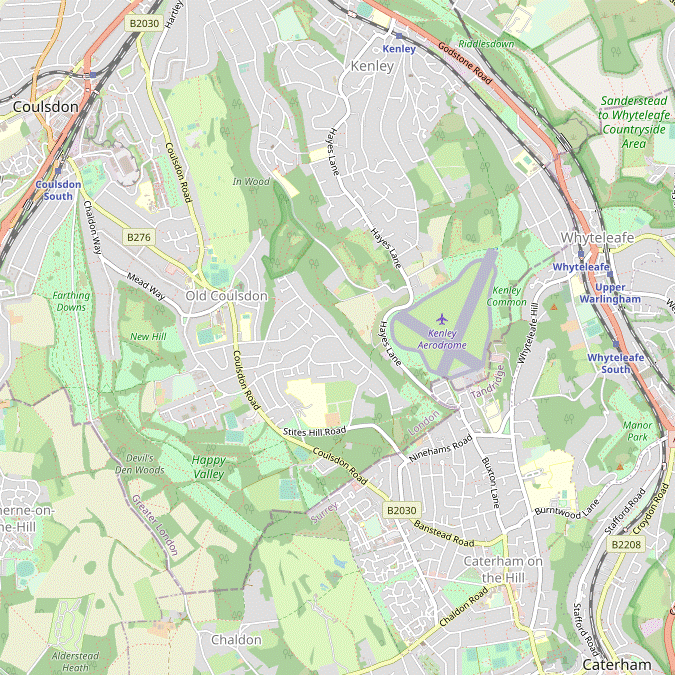
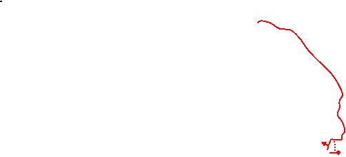
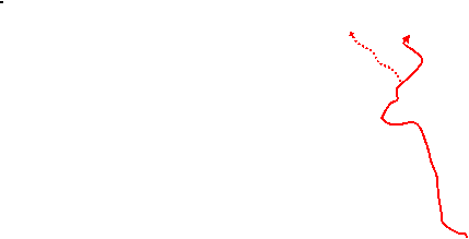

 Walk Map
©
Walk Options
Click on any option to show only the sections making up that route, or the heading above to show all sections.
- Main Walk (16½ km)
Walk Directions
Click on any section heading to switch between detailed directions and an outline, or the heading above to switch all sections.
If you are doing the Alternative Walk (from Coulsdon), start at §D.
- Whyteleafe • Upper Warlingham Station to the Kenley Tribute (2¼ • 2½ km)
- Go via Whyteleafe Hill, Hornchurch Hill and Hilltop Road onto Kenley Common. Follow a footpath up to the northern tip of Kenley Airfield and go around its western perimeter to the RAF memorial on the far side.
-
Starting from Whyteleafe Station
- The shortest way to start the walk is to leave the station by a path at the front of the platform and turn right onto the road (Whyteleafe Hill), going over the tracks at the level crossing. However, if the crossing stays down for a London-bound train you could go over the footbridge to the other platform and cut across the car park to Whyteleafe Hill.
-
Starting from Upper? Warlingham Station (+¼ km)
- Arriving from London, go up the steps in the middle of the platform and turn left on the footbridge to come out by the car park entrance. Bear right across the small forecourt and turn left to go down Station Road.
- At the bottom turn right onto the A22 (Godstone Road) and cross the main road carefully at the traffic island. A little further on, veer left down St Luke's Road. At the bottom turn left and go over the tracks at the level crossing by Whyteleafe Station.
- Go past the station car park and a primary school and turn right at a crossroads to go up Hornchurch Hill. At the next crossroads turn left into Hilltop Road, climbing more steeply. Shortly after this road bends right turn left through a gap in the hedge, going up a few steps onto Kenley Common?.
- Take the grassy path to the right of the information board, climbing towards a wooden gate in the hedge. Go through this and follow the path as it curves gradually to the right, still climbing steadily. At the top keep ahead through a gap in the trees and go through a gate into the next field.
- Follow a faint grassy path climbing towards its top right-hand corner. At the top bear slightly left to head W onto a tarmac area on the edge of Kenley Airfield?, passing between the end of its main runway and a hedge.
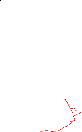
- Continue around the airfield's perimeter (anti-clockwise) for 1¼ km, passing a series of information panels about its wartime history. After going past the end of its short runway the path swings round to the left and comes to the RAF Kenley Tribute? in front of a wartime blast pen, where there are more information panels.
- The Kenley Tribute to The Fox (1½ km)
- Cross Hayes Lane and head south across Coulsdon Common to Stites Hill Road. Cross over and follow a permissive horse ride near the edge of the common to meet the B2030 (Coulsdon Road) near its junction with The Grove. From this side street take a footpath heading west across the common to The Fox.
- Take the tarmac path just beyond the memorial out to the road (Hayes Lane). Cross over and go through the gate opposite onto Coulsdon Common?. Follow the track through a belt of trees and continue on a grassy path sloping diagonally down across a large meadow.
- In the far corner bear right up a wide grassy strip. At the top keep right to start going back downhill, but in about 40m turn left onto a grassy track with a wire fence on the right. In 100m there is a gate into this grazing enclosure (The Maze) and if it is not locked you could cut through it to the bottom corner; otherwise continue around its perimeter.
-
Go down to a road (Stites Hill Road) and cross over into another part of the wooded common. Go uphill on a track and fork left where it splits, now on a permitted horse ride.
- If this ride is excessively muddy you could take a nearby parallel footpath on the edge of the common, alongside the garden fences.
- On the horse ride keep ahead at path crossings. The ride gradually bends left and merges with the footpath by a white-painted Coal Tax post? beside the B2030 (Coulsdon Road). Cross the road carefully and go through a gate onto another part of the common, with a residential street (The Grove) on the left.
- Follow the direction of a footpath signpost, away from the broad grassy strip alongside The Grove and heading W. Follow a clear path through a lightly wooded part of the common to reach a gate in a wooden fence. Go through this and across a patch of grassland towards The Fox pub on the far side.
- The Fox to Chaldon Church (2¼ km)
- Take the lane heading west from the pub. At the car park for the common veer right onto a path going across a meadow. In the far corner take a path heading west through woodland and along the top of an open valley. At the end turn left and go diagonally across Happy Valley. On the far side join the Downlands Circular Walk (DCW) heading south across a large farm field to Ditches Lane and Chaldon church.
- If you are not stopping at the pub this time – the walk returns here after the loop out to Chaldon – pass through a small parking area and turn left onto a short lane (or a parallel grassy path on the adjacent meadow, best accessed via a gap in the ditch near the pillar box).
- Go through a height barrier at the entrance to a car park and immediately veer right through a belt of trees onto a grassy path going diagonally across a meadow. In the far corner there is a wide gap into another meadow and three paths into the wood on your left. Turn left onto the middle of these three paths, to the right of one waymarked as a permitted horse ride.
- In 100m the woodland path emerges into the top of a long narrow open area, sloping down to the left. You could follow the path back into the trees on the right but the suggested route is to take the narrow chalky path along the top of the grassland. At the far end both routes lead out onto the side of Happy Valley?.
-
Bear left down the slope, aiming for a wide gap in the belt of trees across the valley floor. Go through this and continue up the other side of the valley: either on a faint grassy path sloping directly up towards the opposite corner or – just as nice – a more obvious path going straight uphill and turning left along the top edge, joining the Downlands Circular Walk? (DCW).
The remainder of this section follows the Walk 2–15 route (in reverse).
- In the corner follow a potentially muddy track uphill through the trees and continue on a clearly-marked path across a large farm field. In 200m it bends slightly left and a little further on starts to slope downhill to the right-hand side of the field, eventually coming to a gap in the tree boundary.
- Go through the gap and turn left onto Ditches Lane. At a Chaldon village sign in front of a little triangle of roads fork right to go up to the church of Ss Peter and Paul?, which is well worth a visit to see its famous medieval wall painting.
- Coulsdon South Station to Chaldon Church (4¼ km)
- Go out to Reddown Road and follow the London Outer Orbital Path (LOOP) via Marlpit Lane and Downs Road up onto Farthing Downs. Take any of the grassy paths alongside Ditches Lane to the car park at the far end of the downs. Veer left into Devilsden Wood, also joining the Downlands Circular Walk (DCW). In Happy Valley leave the LOOP and follow the DCW along the right-hand side of the valley and then across a large farm field back to Ditches Lane and Chaldon church.
- Arriving from London, take the tarmac path away from Platform 2 and turn left onto Reddown Road, joining the London Outer Orbital Path? (LOOP). At the top turn right onto Marlpit Lane, then almost immediately turn right again into Downs Road, the start of a long but gentle climb up Farthing Downs?.
- Keep right where the road splits after 100m, then in a further 100m keep ahead as indicated by a LOOP waymarker. Go through a wooden gate next to a cattle grid onto the downland. The suggested route is to take the grassy path to the right of Ditches Lane which has good views to both sides of the ridge, but in practice you could take any path parallel to this lane.
- On the right-hand path you climb steadily for 700m and eventually pass an old-fashioned finger post in a small clump of trees. A little further on there is a toposcope off to the left on a stone plinth, and a long level stretch along the top of the ridge brings you to another gate by a cattle grid. Go through this and keep ahead up to a car park, where there is a group of City of London information panels about the area and its history.
- To continue the walk cross Ditches Lane and go across the grass towards the left-hand end of a group of cottages, where there is an information panel for Happy Valley?. Take the broad woodland track indicated by a wooden signpost for the start of the Downlands Circular Walk? (DCW).
- Stay on the main track through Devilsden Wood for 600m (following the LOOP and DCW waymarkers), eventually coming out into the top corner of a sloping meadow. Keep right to go along its top edge, signposted to Chaldon Church. In the next corner take the path ahead into a belt of trees, leaving the LOOP. Keep left at path junctions to emerge into another meadow and go all the way along its top edge, as before.
- …
- …
- Chaldon Church to The Fox (2¼ km)
- From the church go back across Ditches Lane and take a footpath heading east to Leazes Lane. Continue in the same direction along Leazes Avenue and a bridleway going across Surrey National Golf Course, passing the clubhouse and an old burial ground along the way. On the far side turn left onto a bridleway going alongside the redeveloped Caterham Barracks and continue on a footpath across Coulsdon Common to The Fox.
- From the church fork right at the triangle of roads to go back down to Ditches Lane, then immediately turn left onto a signposted footpath. Go up the southern edge of the large farm field you crossed earlier and continue alongside Piles Wood.
- At the end go through a belt of trees and veer right and left across a track (leaving the DCW) to carry on in the same direction along a residential street (Leazes Avenue), with a striking line of redwoods on its left-hand side.
- At the end of the street keep ahead on a signposted bridleway across a golf course (Surrey National), initially downhill on a grassy track between hedges and then up through a copse. At the top it curves right and comes to a (slightly askew) three-way footpath signpost, with the clubhouse on your left.
- Go across an access road and veer left onto a track going down past the side of the clubhouse, the continuation of the bridleway. As before, this goes across a dip and back up through a copse. At the top there is an information panel just inside the small Burial Ground? on the left, which is worth a look.
- The bridleway across the golf course continues on a straight level path between hedges for a further 150m. On the far side turn left at a bridleway T-junction onto a path between the course and a redeveloped residential area.
- In 125m ignore a path off to the right and continue alongside a chainlink fence surrounding a care home (Elizabeth Court). Unless you want to detour to the alternative lunch pub, ignore a cycleway off to the right at the end of this fence and keep ahead on the bridleway for a further 400m to reach a road (The Grove).
-
Detour to The Boundary on the Green (+400m)
- To visit the alternative lunch pub turn right onto the cycleway and keep ahead on a road (Guards Avenue) through the Caterham Barracks? development. In 150m there is a cricket pitch on the left and The Boundary on the Green is on the next corner, 100m further on.
- There are several ways of returning to the bridleway. For the suggested route, go diagonally across the green from the pub to the opposite corner. Bear left through a parking area and turn right in front of “the arc” onto a broad path past the side of this community venue.
- Continue on a tarmac path curving round to the left through a small open area, passing a children's playground. Cross Weston Drive onto a cul-de-sac, where there is a path at the end leading back to the bridleway. Turn right onto it to reach a road (The Grove) in 150m.
- Cross over The Grove, go through a kissing gate and carry on in the same direction across a lightly wooded part of Coulsdon Common. On the far side go through another kissing gate and across a patch of grassland to The Fox pub.
- The Fox to Whyteleafe Bank (3 km)
- Go along Fox Lane to the B2030. Cross over and take a footpath heading north-east and then east across Coulsdon Common to Stites Hill Road. Cross over and follow a permissive horse ride near the edge of the common, then veer left across meadows to Hayes Lane. Cross the road and go past the wartime Rifle Range to Kenley Airfield. Go around the hangars on its southern edge and head north along its eastern perimeter. Veer right onto a path going downhill alongside Coxes Wood. Halfway down, turn left onto a path going along the top of a sloping area of grassland, Whyteleafe Bank.
-
Go out through the small parking area and turn right
…
When you reach the B2030 there is a stop on the left for buses to Coulsdon, Purley and Croydon if you want to abandon the walk.
- To continue the walk cross the main road carefully onto the track opposite through the wooded common. In 100m fork right onto a side path, soon passing a house off to the right. After passing a pond the path drops down to a road (Stites Hill Road).
-
Cross over and go uphill on a permitted horse ride, with a fenced enclosure (The Maze) on your left. As it swings round to the left fork right to stay on the horse ride, uphill through the trees.
- …
- Follow the ride into a semi-open area (taking either fork where it splits), with the Merlewood Estate Offices? off to the right beyond the footpath. When level with the end of Merlewood Close, veer left in front of a wooden fieldgate to stay outside a grazing enclosure, with some fine ornamental trees beyond its fence on your right. Follow the path diagonally down across a small meadow.
- In the bottom corner go through a wide gap beneath some large trees and bear right up a larger meadow to an exit in the tree boundary at the top (not the gap in the far right-hand corner where the Main Walk came in). At the top go up a steep little bank and out through a gate onto a road (Hayes Lane).
- Cross over and go through the gate opposite onto the small part of Kenley Common fringing the airfield. Follow the main path through the trees, but where it swings left to go past a high brick wall (a remnant of the old military Rifle Range) keep ahead up a short slope.
-
At the top go through a gap in the low wall and keep ahead to come to the perimeter fence around Kenley Airfield?.
- On days when there are no gliders operating you might be able to take a short cut across the airfield. If the gates in the fence are open and you decide to do this, aim for the orange windsock 500m away; go out through a gate beyond it and continue the directions at [?].
- At most times you will have to turn right and go around the airfield's perimeter for 800m. After passing the hangars the path turns left to head N along its eastern side. Shortly after passing a weather station and the windsock there is a City of London information board for Kenley Common on the right, opposite the gate in the perimeter fence.
- Although you could continue around the airfield the suggested route is to veer right off the perimeter here, onto a grassy path going downhill alongside Coxes Wood. In 150m there is a tree hedge stretching away to the left above a sloping area of grassland, with broad grassy paths on both sides of the hedge.
-
Turn left and go all the way along the lower of these undulating grassy paths, at the top of Whyteleafe Bank. At the far end go through a wooden side gate.
- You could also take the higher path (on the left of the tree hedge) for the first 250m; this leads to an information panel “The Restoration of Whyteleafe Bank” by a track linking the two paths.
- On the last part of this stretch there is a wooden fieldgate at the start of a low hedge on the right; if it is unlocked you could choose to walk along the sloping bank as there is another gate near the end.
-
Finishing at Whyteleafe Station (+600m)
- Turn right to go steeply downhill to the bottom of the downs. Go through a gate in the fence and zig-zag right and left to go down an awkward flight of concrete steps to a residential cul-de-sac.
- Turn right and then veer sharply left to go out to the main road. Turn left and go down Whyteleafe Hill for 300m. Before reaching the level crossing you can cut across the station car park to Platform 1, for trains to London.
- Whyteleafe Bank to Riddlesdown (2½ km)
- At the far end of Whyteleafe Bank turn left and go back across meadows to the northern tip of Kenley Airfield. Take a track (Hawkhirst Road) heading north through Kenley Common and then a wood, Hawkhirst. Shortly before this leads into a road turn left onto another track (Longwood Road). Towards the far end turn right onto a footpath going down to Valley Road. Go down to the railway line, cross the tracks and go up Bourne View to the A22 (Godstone Road). Cross the road, go up a short path and turn left onto Garston Lane. At the end of this cul-de-sac go up steps on the right onto Riddlesdown.
- To continue the walk from the end of Whyteleafe Bank, follow the grassy path round to the left and uphill. In 50m turn left up a slope and go through a wooden side gate into the corner of a meadow. Ignore the path straight ahead and turn half-right onto a grassy path going diagonally across it.
-
In the far corner bear right to go through a gap in the trees, crossing over the outward route of the Main Walk just before it went past the airfield's main runway. Keep ahead at a path crossing to continue on a track heading N, initially between grassy banks and then on the edge of woodland.
- Alternatively, you could take a parallel route along the top of the adjacent meadow for 350m, with views across the valley to your return route above Riddlesdown Quarry.
-
At the end of the meadow on the right keep ahead at a path crossing with a City of London information board for Kenley Common. Follow this woodland track (a permissive bridleway shown as Hawkhirst Road on maps) gently downhill for 500m, eventually coming to a cleared area on the right with views across the valley.
Some rather forbidding notices have appeared on Hawkhirst Road, to which the landowner has responded with his own notice confirming that “there is absolutely no issue with the public using this permissive path…you are all actively encouraged to use it”.
-
Before the track leads into the road ahead, turn left onto another woodland track (Longdown Road on maps). In 350m, again just before reaching a road, turn right onto a signposted footpath. Follow this twisting narrow path downhill alongside garden fences for 400m, eventually coming out onto a residential street (Valley Road).
- If you want to skip the rest of the walk Kenley station is 600m away to the left, on Valley Road (see the Walk Map).
- To continue the walk cross Valley Road onto a path leading down to the railway line. Cross the tracks carefully and go up Bourne View to the A22 (Godstone Road). Cross this main road carefully and take the short path opposite up to Garston Lane.
- Turn left to go along this cul-de-sac, parallel to and just above the main road. Just before reaching the end turn right at a footpath signpost and go up a flight of steps between houses onto Riddlesdown?.
- Riddlesdown to Whyteleafe • Upper Warlingham Station (2¾ km)
- Take any path slanting up to the right, crossing a track (Riddlesdown Road) and climbing to the top of the Sanderstead to Whyteleafe Countryside Area. Carry on past the top of Riddlesdown Quarry to the south-western corner of the downland. Go down a flight of steps into Whyteleafe Recreation Ground, which has a café. To complete the walk go out through its car park and turn right onto the B270 (Hillbury Road). Turn left for Upper Warlingham station or go across the A22 for Whyteleafe station.
-
At the top of the steps ignore the footpath sign pointing left and bear right uphill on a chalky path, crossing a small open area. Go through a wooden kissing gate and follow a winding path up steps through a copse.
Through the chainlink fence on the right you can see that you are crossing over the southern end of the Riddlesdown Tunnel on the Oxted railway line.
- At the top you come out onto a strip of grassland. Go though a gate in the hedge on the right and follow a grassy path slanting uphill, soon crossing over a stony track (shown on maps as Riddlesdown Road; it was used by vehicles until the 1970s).
- Carry on near the top of the grassland for a further 250m. Ignore the first gate into the woodland on your left but veer left through the second gate into the bottom of a small meadow, entering the Sanderstead to Whyteleafe Countryside Area? (SWCA).
- Take a clear grassy path slanting up across the meadow to its top right-hand corner. Go through a gap in the trees and go straight across it, ignoring a path off to the left. For the next 1¼ km you will be following grassy paths along the top of the downs, staying about 50m from the tree boundary on the left and always heading roughly SE.
-
After going through a gap in the hedge at the end of this meadow take the right-hand of the two paths ahead, almost straight on. In a further 150m (shortly after passing a wooden bench) the most direct route is to fork left where the grassy path splits.
The right fork carries straight on past a few more benches but later it has to veer left in front of a large quarry; the left fork simply straightens out the kink where the original right of way had to be diverted. At this point you should be able to make out some of your earlier route across the valley, including the end of the main runway on Kenley Airfield.
- The path continues along a broad grassy strip past the top of Riddlesdown Quarry?, protected by metal railings. In the far right-hand corner go though a gap in the belt of trees ahead and follow a path across another large meadow, curving slightly to the right.
- On the far side turn half-right onto a faint grassy path, gradually approaching the woodland ahead which is at the top of a steep slope. There are several ways down through this bank of trees into Whyteleafe Recreation Ground, but by far the easiest is a path through a gap at the right-hand end of these trees, which leads to the top of a long flight of steps.
- Towards the bottom of these steps you can veer left across the grass, passing the end of a children's play area. Make your way onto the tarmac path leading to the small car park on the far side of the Recreation Ground. The Pavilion Café is in the low building off to the left of this path.
-
To complete the walk leave the Recreation Ground through the car park. Turn right onto the B270 (Hillbury Road) and go under the railway bridge.
- To go directly to Upper Warlingham station, turn left at the mini-roundabout and go all the way up Station Approach. If the ticket hall is locked, there is a gap onto Platform 1 (for trains to London) by the car park ticket machines.
- For other refreshment options, or for Whyteleafe station, carry on down Hillbury Road and turn left onto the A22 at the large roundabout. The Whyteleafe Tavern is on the other side of the road here; the Radius Arms, Dzerts and the Whyteleafe Café are in the parade of shops ahead on the left-hand side (although the café will probably have closed).
-
Finishing at Whyteleafe Station
- Either take the alleyway from the pedestrian lights by the shops or go down the road from the roundabout. If the level crossing is down, you can reach Platform 1 (for trains to London) via the footbridge from Platform 2.
-
Finishing at Upper Warlingham Station
- Carry on along the A22 and turn left into Station Road to come to the station at the top. …
- The station on the Oxted line was named ‘Upper’ Warlingham when it opened in 1884 to distinguish it from another station called Warlingham, lower down the valley on the Caterham line. It retained the unnecessary prefix when that was renamed Whyteleafe South in 1956.
- Kenley Common, Coulsdon Common, Farthing Downs and Riddlesdown are owned and managed by the City of London Corporation. They are four of the seven “City Commons” in Surrey and south London which were purchased in the 1880s to preserve the area as open countryside for Londoners.
- Kenley Airfield is one of the three RAF stations on the southern outskirts of London specifically tasked with its defence in the Battle of Britain (the others were Croydon and Biggin Hill). It is owned by the Ministry of Defence and is still in active use by RAF air cadets and Surrey Hills Gliding Club, but the surrounding land is part of Kenley Common and open to the public.
- The RAF Kenley Tribute was sculpted by Bridget Kendall in white Portland stone and installed in August 2000. It honours all the personnel who served from 1917–1959.
- Cast-iron Coal Tax posts were erected in the 1860s to mark a taxation boundary. A levy on coal had been brought in to help pay for the rebuilding of London after the Great Fire of 1666, and with the growth of road and rail transport it was no longer practicable to collect it in the Port of London.
- Happy Valley was purchased by Croydon Corporation in 1937 as public open space, in part to link the neighbouring City of London Commons into a contiguous area of Green Belt land.
- The Downlands Circular Walk is actually two overlapping circular walks around Happy Valley and Chaldon. The longer (6 mile) walk runs between Farthing Downs and the North Downs Way; the shorter (3 mile) option is similar to this walk's ‘Chaldon loop’ from The Fox pub.
- Ss Peter and Paul, Chaldon dates from 1086 and is Grade Ⅰ listed. Its west wall is covered with a 12thC ‘doom mural’ in red and yellow ochre, the earliest known English wall painting. Intended as a visual aid to religous teaching, it depicts Purgatory and Hell with the ‘Ladder of Salvation of the Human Soul’.
- The London Outer Orbital Path – the ‘M25 for walkers’ – runs for 240 km around outer London, from Erith in Kent to Purfleet in Essex.
- The Burial Ground has been preserved as a memorial to the thousands of patients of St Lawrence's Hospital (formerly Caterham Metropolitan Asylum) who were buried here from 1916–1965. A chapel on the site was demolished in 1971 and the hospital itself finally closed in 1994. The garden is ringed by black pines and also contains a fine western red cedar.
- Caterham Barracks were built in 1877 as a depot for the Foot Guards regiments. After the barracks closed in 1995 the site was redeveloped by Linden Homes as ‘The Village at Caterham Barracks’.
- The Merlewood Estate Offices are the operational yard for the City of London Corporation, housing their stock of Sussex cattle and Jacob's sheep which graze the commons.
- The Sanderstead to Whyteleafe Countryside Area is jointly owned by Croydon and Tandridge Councils and the Whitgift Foundation. The three owners are working with Natural England to restore the 200 acres of chalk downland under the Countryside Stewardship Scheme.
- Chalk was mined at Riddlesdown Quarry from the late 18thC to 1967, and burnt in kilns to produce lime. The site was bought by the City of London Corporation in 1996 and is part of Riddlesdown's Site of Special Scientific Interest.
The most convenient station for this walk is Whyteleafe, but it is only a little further from Upper Warlingham.
If you are doing the Short Walk (omitting the Chaldon loop), go to §F.
Continue the directions at §E.
As noted in the introduction, this section essentially follows the ending of the Walk 2–15 route (in reverse).
The start and finish of this section follow the Walk 2–15ab route (in reverse), but the central stretch across the golf course is different.
The short stretch to Stites Hill Road follows the Walk 2–15 route (in reverse).
If you want to skip the rest of the walk and go directly to Whyteleafe station, follow the directions below.
Walk Notes
» Last updated: April 23, 2024
Return to Top | Walk Map | Walk Options | Walk Directions.