Hastings to Rye Walk
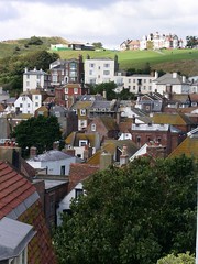
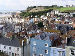
Seaside Hastings, a hilly cliff walk with 4 steep climbs and a remote naturist beach. Gentle afternoon to historic Winchelsea and Rye via a noted viewpoint.


One Cinque port and two ancient towns
| Length |
Standard walk: 19.0km (11.8 miles), 6 hours. For the whole outing including trains, sights and meals allow at least 11 hours Short walk: 9.5km (5.9 miles), 3 hours. |
|---|---|
| Maps |
OS LandRanger Map Nos. 189 and 199. OS Explorer Map Nos. 124 and 125. Hastings, map reference TQ814097 is in East Sussex. |
| Toughness |
7 out of 10 |
| Features |
This rewarding walk starts with a fine clifftop coastal walk with steep climbs along the way. This section is the most strenuous part of the walk. Lunch is at Pett Level, after which the terrain levels out, before leading up through the New Gate into Winchelsea for tea. After tea and just east of the town, you reach The Look Out, offering panoramic views across the whole of Romney Marsh and the Kent Downs beyond. From there it is down and along to Ferry Bridge, following an easy flat route north east to Rye. |
| Walk Options |
You may reduce the length of the standard walk by 9.5km to 9.5km (6 miles) by following the main route directions as given until [2]. Then follow the Shortened route directions which go past the Caves and the Castle to finish at Hastings. You may also reduce the length of the walk by 2.5km to 16.5km (10 miles) by finishing at Winchelsea station. There is also the option of catching the 100 bus (stagecoach) from Pett Level to Rye (Mon - Sat hourly, Sun & BH every 2 hours), reducing the length of the walk by 9km to 10km. |
| History |
Hastings nowadays is most famously connected with the battle of 1066, although it existed long before as a small community, to become a Saxon settlement after the Romans left early in the 5th century, taking its name from the group of Saxon invaders, the Haestengas. Hastings Castle (tel 01424 781111) was built high on the sandstone rocks above the town, by William the Conqueror in 1067. Although just a ruin today, it is still worth a visit which includes the dungeons and an exhibition area. The castle is open 10am - 5pm, daily from April until August. 11am - 3pm daily, from September to March. St. Clements Caves, West Hill, Hastings(tel 01424 422964) have over time been put to many uses including a military hospital, an air raid shelter and even a dance hall. Open 11am - 5.30pm, daily from Easter until September. 11am - 4.30pm, daily from October to Easter. Visiting Winchelsea today it can be difficult to imagine with the sea over 2km away, that 700 years ago it was one of England's leading ports. This new town of Winchelsea replaced the earlier old town, which was sited on a massive shingle spit somewhere out towards Dungeness (probably offshore from the village of Camber). The old town of Winchelsea was devastated by storms in the 13th century, with the great storm of 1287 causing its final destruction. At the time, the loss of Winchelsea could be compared to losing Portsmouth today, such was its importance. King Edward I ordered a commission to find a new site for the town. Building commenced in the 1280s, from the Strand to the New Gate (where you can see the deepest section of the town ditch around Winchelsea, part of the town's defence), with the streets being laid out on a grid system. The wealth of new Winchelsea in its heyday was based largely on its huge wine trade. (There are 47 known cellars in the town.) Other trades included wool, timber, iron, shipbuilding and repair. Winchelsea along with Rye emerged to be of far more importance than Hastings (one of the Cinque Ports along with Sandwich, Dover, Hythe, Romney). The storms of the late 13th century, which had destroyed old Winchelsea, caused silting of the Hastings harbour ruining its future as a port. Thus Winchelsea and Rye joined the Cinque Ports to become the ancient towns whose duty in the days before a navy, was to defend England's most vulnerable coastline and provide transport for the King and his retinue in return for trading privileges. The King effectively gave them a licence for piracy, allowing them to attack anybody in the channel. However the heyday of new Winchelsea lasted only a few generations. By the middle of the 14th Century the town was in terminal decline. In the 1340s it started to suffer from shingle drifts, and was unable to get ships easily in and it started to lose its livelihood. Eventually the returning shingle bank sealed the town's fate. St. Thomas' Church, Winchelsea is semi ruinous. All that's left (the transepts and the eastern end) is about a third of the original 59 metre long building, although it is still a functioning church. It was badly damaged during various raids; particularly a French and Spanish raid towards the end of the 14th century. With the town in decline the damaged sections were quarried rather than being repaired. The Look Out is named from the days when the look out man was stationed here during the French wars. It is also the site of Winchelsea windmill destroyed in the hurricane of 16th October 1987. Rye as a port faired much better than Winchelsea and benefited from its decline and final abandonment as a port in the early 16th century. However over the centuries it had constant battles with nature, being affected by the eastward drift of shingle across the mouth of the harbour, and the enclosing of the salt marshes along the rivers Rother and Brede causing gradual siltation. |
| Travel |
Take the train nearest to 9.00am (before or after) from London Charing Cross station to Hastings. Journey time is 1 hour 30 minutes. Trains back from Rye run once an hour. Journey time 2 hours. Buy a day return to Rye. Its usually quicker to return from Rye by changing at Ashford. Slow trains to Charing Cross and Victoria take about 2 hours, and high speed trains (at a supplement) to St Pancras take 1 hour 10 mins. |
| By car |
Park centrally anywhere east of Hastings centre along the route. Return to Hastings by direct train, or regular bus.. |
| Lunch |
Standard walk The suggested lunchtime stop is The Cove, 53 Waites Lane, Fairlight, TN35 4AX., (tel 01424 814772) 8km from the start of the walk. Lunch 12.30 - 14:30. Closed Mon and Tue. If walking at a more relaxed pace you are advised to take along a picnic, or alternatively stop at the earlier Coastguard Café (600 metres inland, off route). A later lunch option in Pett Level is Eater's a cafe just off the promenade. (The Smuggler Inn pub has closed.) Short walk The suggested refreshment stop is West Hill Café (tel 01424 429636) open 10am to 5.30pm summer, and 10am to 4pm winter, 1km from the end of the walk. If wishing a pub, then the recommended stop is The John Logie Baird (Wetherspoons, tel 01424 448 110), Hastings ½km from the end of the walk. Picnic Once out of Hastings, virtually anywhere along the route would be a good picnic spot. |
| Tea |
Standard walk The New Inn, German Street, Winchelsea (T:01797 226252) Rye - Many pubs and tea rooms, a chip shop en-route, and a large supermarket by the station. |
| Misc. |
Dozens of dinosaur prints exposed following periods of extensive coastal erosion along the cliffs to the east of Hastings. |
| Tides |
29-Apr :
low: 07:38
high: 12:48
low: 19:51
30-Apr :
high: 01:09
low: 08:20
high: 13:31
low: 20:33
01-May :
high: 01:52
low: 09:01
high: 14:16
low: 21:16
02-May :
high: 02:40
low: 09:42
high: 15:05
low: 22:01
03-May :
high: 03:32
low: 10:28
high: 15:59
low: 22:53
04-May :
high: 04:31
low: 11:25
high: 17:00
05-May :
low: 00:00
high: 05:40
low: 12:39
high: 18:08
Times for . Corrected for BST if appropriate. Contains ADMIRALTY® tidal data: © Crown Copyright and database right.
|
|---|---|
| Book |
This walk was originally published in Time Out Country Walks near London volume 2. We now recommend using this online version as the book is dated. |
| Landslip |
Landslip at Ecclesbourne GlenThe coast path has been repaired and reopened, and is now part of the England Coast Path Ecclesbourne Glen is a hanging valley [*] on the coast path between Hastings' East Hill and Fairlight Glen. The coast path was closed at this point after a major landslip in winter 2013/14, and further landslips in winter 2014/15 and 15/16. The area has now greened over and stable. The landslip is now deemed dormant, and the path was finally reopened in autumn 2021. [*] The Glen doesn't quite go down to the beach, there's a low cliff at the end, just a little too high and vertical to climb up/down. |
| Fairlight Glen Beach |
The path down to Fairlight Glen naturist beach (Covehurst Bay on the OS map, but this name isn't used locally) has been officially "closed" for many years. However, the path is currently in good condition, as a local has been maintaining it, and he's done an excellent job. If walking up from the beach, look for subtle white paint on some trees by the start. If you can manage a style, you should be fine [Jun-21] This area is very active - there are landslips every few years. From the beach, on a falling tide, it's possible to walk west to Hastings although it's heavy going over the pebbles. You pass a new undercliff on the way, but beware, there are no escape routes from the beach until Hastings. You can also walk east to Petts Level beach, passing a sandy beach below Fairlight village. Beware - you can only get around the headland at low tide. You could climb the cliff to Fairlight Village in an emergency (you'd have to trespass through someone's garden to get to the top). |
| County Park | |
| Profile | |
| Help Us! |
After the walk, please leave a comment, it really helps. Thanks! You can also upload photos to the SWC Group on Flickr (upload your photos) and videos to Youtube. This walk's tags are: |
| By Train |
Out (not a train station) Back (not a train station) |
| By Car |
Start Map Directions Return to the start: Finish Map Directions Travel to the start: |
| Amazon | |
| Help |
National Rail: 03457 48 49 50 • Traveline (bus times): 0871 200 22 33 (12p/min) • TFL (London) : 0343 222 1234 |
| Version |
Nov-23 DAC |
| Copyright | © Saturday Walkers Club. All Rights Reserved. No commercial use. No copying. No derivatives. Free with attribution for one time non-commercial use only. www.walkingclub.org.uk/site/license.shtml |
Walk Directions
Full directions for this walk are in a PDF file (link above) which you can print, or download on to a Kindle, tablet, or smartphone.
This is just the introduction. This walk's detailed directions are in a PDF available from wwww.walkingclub.org.uk


