Greensand Way 11 : Ashford to Ham Street Walk
Greensand Way Stage 11 - the Great Stour River out of Ashford, new housing and a landfill, then pretty through pastures and Ham Street Woods NNR

Buxford Fish Pass
SWC Walk 153 - Ashford to Ham Street (Greensand Way Stage 11)
Dec-20 • thomasgrabow on Flickr
swcwalks swcwalk153 banner 50675368482

Hubert Fountain, Victoria Park, Ashford
SWC Walk 153 - Ashford to Ham Street (Greensand Way Stage 11)
Dec-20 • thomasgrabow on Flickr
swcwalks swcwalk153 walkicon 50675369517

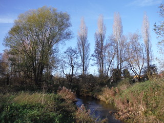
Poplars along Great Stour River, Ashford
SWC Walk 153 - Ashford to Ham Street (Greensand Way Stage 11)
Dec-20 • thomasgrabow on Flickr
swcwalks swcwalk153 walkicon 50675285981

Churchyard with North Downs Views: St. Mary's Great Chart & Singleton
SWC Walk 153 - Ashford to Ham Street (Greensand Way Stage 11)
Dec-20 • thomasgrabow on Flickr
swcwalks swcwalk153 walkicon 50674536888

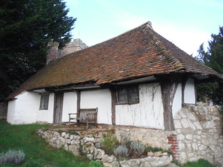
Pest House, St. Mary's Great Chart & Singleton
SWC Walk 153 - Ashford to Ham Street (Greensand Way Stage 11)
Dec-20 • thomasgrabow on Flickr
swcwalks swcwalk153 walkicon 50675285136
| Length |
17.2 km (10.7 mi) with 121m ascent 25.8 km (16.0 mi) if you combine this stage with the previous one from Pluckley to Ashford. |
|---|---|
| Toughness | 2 out of 10 |
| Walk Notes |
This is the 11th and final stage of the Greensand Way (GW) - from Ashford to Ham Street. The morning of this walk starts with a very acceptable urban stretch out from Ashford's station, following the Stour Valley Walk, through parks and along the Great Stour river, to regain the ending of the route from Stage 10. It then skirts Ashford's sprawling suburbs with its many new estates and passes a couple of walker-unfriendly farms. Some pretty countryside follows though, with tranquil pastures and the enchanting Ham Street Woods National Nature Reserve (the latter along a mud-prone bridleway), all the way to the fine village of Ham Street. The urban sprawl circling around Ashford makes this the least rural stage of the GW. It is possible to merge this stage with the previous stage, Pluckley to Ashford, avoiding the routing to and from Ashford's centre, but it then comes in at 25.8 km / 16 miles. Notes:
|
| Travel |
Catch a direct train (normal or high speed) to Ashford. Buy a day return to Ham Street. Ham Street is 1 stop from Ashford on a branch line. |
| Eat |
|
| Author's Note |
The walk starts by heading east from Ashford Station (retracing the end of the previous stage) to the outskirts of Ashford. It then circles around the city to the south (i.e. from "9" to "6" ), before heading across countryside towards Ham Street. I did look at a shortcut, due south from Ashford Station to regain the Greensand Way south of Ashford, thus missing out the urban sprawl around the outskirts, but could not find no suitable route. Suggestions welcome! |
| Greensand Way |
This walk is one of 11 stages of the Greensand Way - a regional long distance path in the Southeast of England |
|---|---|
| Links |
|
| Profile | |
| Help Us! |
After the walk, please leave a comment, it really helps. Thanks! You can also upload photos to the SWC Group on Flickr (upload your photos) and videos to Youtube. This walk's tags are: |
| By Train |
Out (not a train station) Back (not a train station) |
| By Car |
Start Map Directions Return to the start: Finish Map Directions Travel to the start: |
| Map Walk | This walk requires an OS map and a compass or GPS for navigation. You can print out OS maps using the link above. |
| Amazon | |
| Help |
National Rail: 03457 48 49 50 • Traveline (bus times): 0871 200 22 33 (12p/min) • TFL (London) : 0343 222 1234 |
| Version |
Dec-20 Andrew |
| Copyright | © Saturday Walkers Club. All Rights Reserved. No commercial use. No copying. No derivatives. Free with attribution for one time non-commercial use only. www.walkingclub.org.uk/site/license.shtml |


