Cholsey to Goring Walk
Fairly gentle climbs through Oxfordshire and Berkshire countryside ending with a southerly stretch along the Thames.

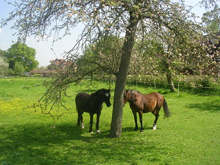
Horses seeking shade
Extra walk: Cholsey to Goring That blue stuff is sky.
book3 swcwalks walk49 2476013913


Thatched walls, Blewbury
For the village that has everything. Extra walk: Cholsey to Goring
book3 swcwalks walk49 2476829698


| Length | 23.5km (14.6 miles) |
|---|---|
| OS Map | Landranger 174, Explorer 170 |
| Toughness | 3 out of 10. |
| Walk Notes |
This walk offers a fine combination of gentle Oxfordshire countryside, wide grassy horse training gallops, a stretch of the Ridgeway with splendid views from the Berkshire Downs, and a final saunter along the banks of the Thames. Although the walk is fairly long, it has nothing too steep or demanding. The main walk is best undertaken from mid spring to early autumn. With a fairly late start to accommodate the early lunch stop at The Red Lion Blewbury. The suggested tea stop is the Beetle and Wedge riverside restaurant at Moulsford, a place with ‘Wind in the Willows’ and ‘Three Men in a Boat’ associations. There are also plenty of hostelries in Streatley and Goring at the end of the walk. Before starting the walk, devotees of Agatha Christie’s detective stories might want to make a short detour to visit the novelist’s grave in the churchyard of St Mary’s, Cholsey. To do this, follow the walk directions for the first 180 metres till you reach the railway bridge, but instead of turning left under the railway, turn right and follow the path for 700 metres as it climbs up to the church. Afterwards, retrace your steps and pass under the railway to rejoin the directions. |
| Walk options |
Goring circular walk via Moulsford You may combine these directions with the Goring circular walk directions (17) for a 20 km (12.4 mile) Goring circular walk via Moulsford, finishing with a 2.5 km southerly walk along the Thames. Use the Goring circular walk directions until the Bell Inn [6], then these directions. |
| Saturday Walkers Club | Take the train nearest to 10.00am (before or after) from Paddington. |
| Lunch |
The recommended lunch stop is The Red Lion, Blewbury. |
| Tea | The Beetle and Wedge |
| Profile | |
|---|---|
| Help Us! |
After the walk, please leave a comment, it really helps. Thanks! You can also upload photos to the SWC Group on Flickr (upload your photos) and videos to Youtube. This walk's tags are: |
| By Train |
Out (not a train station) Back (not a train station) |
| By Car |
Start Map Directions Return to the start: Finish Map Directions Travel to the start: |
| Amazon | |
| Help |
National Rail: 03457 48 49 50 • Traveline (bus times): 0871 200 22 33 (12p/min) • TFL (London) : 0343 222 1234 |
| Version |
May-23 DAC |
| Copyright | © Saturday Walkers Club. All Rights Reserved. No commercial use. No copying. No derivatives. Free with attribution for one time non-commercial use only. www.walkingclub.org.uk/site/license.shtml |
Walk Directions
Full directions for this walk are in a PDF file (link above) which you can print, or download on to a Kindle, tablet, or smartphone.
This is just the introduction. This walk's detailed directions are in a PDF available from wwww.walkingclub.org.uk
