Pluckley Circular Walk
Gentle walk through quiet Kent Orchards with ancient pubs - Darling Buds of May territory. Hilly afternoon options.

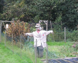
Scarecrow
Nov-06 • msganching on Flickr
walks englishcountryside book2 swc walk21 pluckleycircular tocw221 483131204

Sunset
Winter sky in Kent.
Nov-06 • msganching on Flickr
sky walks dusk englishcountryside book2 walk21 pluckleycircular tocw221 484010030

Pluckley - Trees
The Pluckley Circular walk.
Nov-06 • msganching on Flickr
trees sky walks englishcountryside swc swcwalks pluckleycircular tocw221 483535894

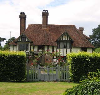
English Country Cottage
Pluckley Circular. This photograph was taken in Little Chart Forstal the village where H. E. Bates lived.
Jun-08 • msganching on Flickr
houses roses england house gate walks cottage chimneys book2 swc timberframed swcwalks pluckleycircular tocw221 littlechartforstal 2637972889

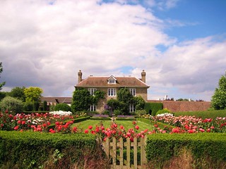
English Country House
Thanks to everyone who has commented on and made this photograph a favourite. I am glad that so many people like it however please do not use this photograph without my permission. A few people have used this image on blogs which I have no problem with but some others have used it on sites which are purely for advertising.
Jun-08 • msganching on Flickr
uk houses roses england house building english gardens kent walks country cottage explore book2 swc pluckleycircular tocw221 2625549461
The Low Weald of Kent and The Darling Buds of May
| Length |
Main walk: 11.7km (7.3 miles). With shorter extension: 14.2km (9.3 miles) With longer extnension: 17.7km (11 miles) |
|---|---|
| Maps |
OS Landranger Map : 189, OS Explorer Map : 137 |
| Toughness |
Main walk: 1 out of 10, almost entirely flat. Extensions: 3 out of 10
|
| Features |
This is a gentle walk in a low lying area of Kent, made famous by the writer H.E Bates, who lived in the village of Little Chart Forestal, passed on this walk. This is quiet country: there are no great landscape features, no grand houses, and yet this is a quintessentially English walk, with fields, orchards, a couple of ancient pubs (one allegedly the most haunted in England), and towards the end, a fine and unexpected view over the Kentish landscape. The walk is at its most perfect in late April or early May when the apple blossom is out, the lanes are lined with drifts of cow parsley, and there are not infrequently vast fields of yellow oilseed rape somewhere or other on the walk. Interest on the walk is provided by the arched ‘Dering windows’ seen on many of the houses, which reflect the fact that this land was owned for nearly nine hundred years by the Dering family, who received it as a grant from William the Conqueror. |
| Walk options |
Since the main walk is quite short, two options to extend it are offered, one being a short cut of the other. The shorter version of the extension adds 3.2km (2 miles) to the walk, making a total walk of 14.9km (9.3 miles), while the full version adds 6km (3.7 miles), making a total walk of 17.7 km (11 miles). Both routes climb to a fine viewpoint on the Greensand ridge, with the longer version following the crest of the ridge for a short distance. The extensions also include pubs that are possible tea stops. |
| Transport |
Two trains an hour (one an hour on Sunday) go from Charing Cross to Pluckley (journey time 1 hour 15 minutes). A slightly quicker, but more expensive, option is to take a Southeastern High Speed train from St Pancras, and change there to approach Pluckley from the other direction. Take the train nearest to 10am to get to lunch in time. For those driving, there is a paid car park at Pluckley station. |
| Points of interest |
All the land on which this walk takes place was owned for almost 900 years by the Dering family: they only sold it in 1928. A particular feature of their estates are the distinctive arched Dering windows on all the houses, which were added during Victorian times in reference to a story that during the English Civl War a Dering baronet gave his Roundhead pursuers the slip by leaping to freedom through such a window. You can also see the Dering family crest of a black horse on the cowls of the oast houses, and in the south chapel of St Nicholas Church in Pluckley. The writer H E Bates (1905–74) lived in Little Chart Forstal. His service in the Royal Air Force during the Second World War yielded many short stories such as Flying Officer X, but he is perhaps best known for The Darling Buds of May, a tale of rural life, which was made into the popular TV series starring David Jason and Catherine Zeta Jones. During the Second World War, doodlebugs (German V1 flying bombs) caused much damage, earning the village the nickname of 'bomb alley'. Little Chart’s medieval church was destroyed and was replaced by the 1950s built St Mary the Virgin. The TV series of The Darling Buds of May was filmed in the pretty village of Pluckley, but it has another claim to fame - as reputedly the most haunted village in the country, claiming at least 12 ghosts. The Black Horse supposedly boasts a discerning poltergeist who preys only on teetotallers, sweeping orange juices aside with an unseen hand. Meanwhile the churchyard of nearby St Nicholas Church is allegedly haunted by a Red Lady who sobs as she searches for the unmarked grave of her stillborn baby. Pluckley Station opened in 1842 and the timber-framed, Kentish-style clapboard building remains largely unchanged, possibly making it the oldest station in the world. When it was built, the staff would have comprised the stationmaster, two clerks, two signalmen, two porters who doubled as shunters, and a plate layer, or lengths man, who maintained the track. There were also several goods sidings, which were situated beyond the bridge (originally a level crossing). Coal was brought in by rail and sold on to local residents by a coal merchant. Charmingly, this business survived in the area to the left of the station entrance until as recently as 2017. |
| Lunch and Tea |
Swan Inn Little Chart, (01233 840011). Located 5.8km (3.6 miles) into the walk, has a riverside garden and serves food from 12-3pm Tuesday to Thursday and 6pm to 8pm Wednesday to Thursday: on Friday, Saturday and Sunday food is served all afternoon, and the pub is open all afternoon daily for drinks. The Black Horse Pluckley, (01233 840380), 7.8km (4.8 miles) into the walk, apparently reopened in September 2024 after a period of closure. It seems to have reverted to being a pub rather than a restaurant, but we have not yet had a chance to check out its food offering or opening hours. The George Egerton (1233 756 599), 11.5km (7.1 miles) into the walk via the longer version of the extension, is a smart modern pub with plenty of space inside and a few tables outside, serving a fairly classic pub menu. It is open all afternoon and evening Wednesday to Sunday (its website says Monday and Tuesday also, but staff told me different in March 2022, so check.) The Rose and Crown in Mundy Bois (01233 840048), is 14.4km (8.9 miles) into the walk via the longer version of the extension, and 11.7km (7.2 miles) via the shorter version of the extension. It is also reachable via a 1.5km (0.9 mile) diversion from the main walk route. This pub has a delightful rural location, comfortable sofas, and a garden with charming views of the fields. It is open all afternoon daily for drinks, and serves food all afternoon on Fridays, Saturdays and Sundays, and from 12pm-2.30pm and 6pm-9pm Monday to Thursday. The Dering Arms (01233 840371) by Pluckley station is a former hunting lodge which is now an award-winnning seafood restaurant. Booking is necessary to eat there, but you can have drinks in its cosy bar area and also at a few outside tables. It is open to 3pm and from 6pm Tuesday to Saturday, but only until 4pm on Sundays. Closed Mondays. Picnic : Just across the road from the Swan Inn in Little Chart, there is a grassy field beside the church, which makes a good picnic spot. The churchyard at St Nicholas in Pluckley village is another good choice. |
| Book |
This walk was originally published in Time Out Country Walks near London volume 2. We now recommend using this online version as the book is dated. |
|---|---|
| Profile | |
| Help Us! |
After the walk, please leave a comment, it really helps. Thanks! You can also upload photos to the SWC Group on Flickr (upload your photos) and videos to Youtube. This walk's tags are: |
| By Train |
Out (not a train station) Back (not a train station) |
| By Car |
Start Map Directions |
| Amazon | |
| Help |
National Rail: 03457 48 49 50 • Traveline (bus times): 0871 200 22 33 (12p/min) • TFL (London) : 0343 222 1234 |
| Version |
Sep-24 Peter |
| Copyright | © Saturday Walkers Club. All Rights Reserved. No commercial use. No copying. No derivatives. Free with attribution for one time non-commercial use only. www.walkingclub.org.uk/site/license.shtml |
Walk Directions
Full directions for this walk are in a PDF file (link above) which you can print, or download on to a Kindle, tablet, or smartphone.
This is just the introduction. This walk's detailed directions are in a PDF available from wwww.walkingclub.org.uk


