Greensand Way 5 : Earlswood to Oxted Walk
Greensand Way Stage 5 : A gentle ridge walk through a quiet part of Surrey. Regularly spaced pubs.

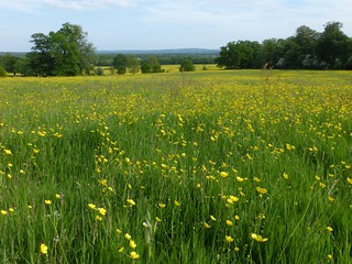
Buttercup meadow, Tandridge
Earlswood to Otford walk
May-15 • Saturdaywalker on Flickr
walkicon swcwalks swcwalk148 18420099968

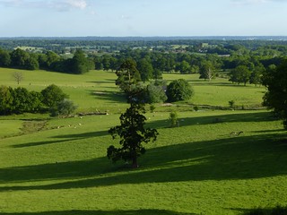
View from just before Bletchingley
Earlswood to Otford walk
Jun-15 • Saturdaywalker on Flickr
walkicon swcwalks swcwalk148 17985197534

Buttercup meadow, Tandridge
Earlswood to Otford walk
May-15 • Saturdaywalker on Flickr
swcwalks swcwalk148 18420172520

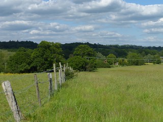
Earlswood start
Earlswood to Otford walk
Jun-15 • Saturdaywalker on Flickr
swcwalks swcwalk148 18420100988

Earlswood start
Earlswood to Otford walk
Jun-15 • Saturdaywalker on Flickr
swcwalks swcwalk148 18603312422
| Length | Earlswood to Oxted: 16.9km (10.5 miles) Nutfield to Oxted: 14.2km (8.8 miles) | ||||
|---|---|---|---|---|---|
| Toughness | 4 out of 10 (320m / 1050 feet of ascent - gently undulating) | ||||
| Walk Notes |
This is a pleasant section of the Greensand Way: the fifth stage of it and the end of the Surrey section. (See maps 8, 9 and 10 on the Surrey website - link below). It passes through gentle Surrey countryside, with a mix of pasture, arable fields and woodland, and some fine escarpment views typical of the Greensand Way (more views in winter than in summer, but still plenty at any time of the year). There are several bluebell woods in late April and early May. The start of the walk (from Earlsfield to Nutfield) and the last section (from Tandridge to Oxted) are more low-lying. Pubs are regularly spaced throughout the walk. Waymarking on the route is often fairly poor, hence these directions. While the route largely follows the Greensand Way, in a couple of places alternatives are suggested to avoid walking on busy roads. Just after Nutfield you cross (in tunnels or underpasses) under the M23 motorway and inevitably there is noise from that for a while. If winds are westerly the noise starts when you cross the motorway and fades as you approach Bletchingley. If winds are easterly the noise affects the section between South Nutfield village and the motorway. |
||||
| Walk Options |
Two possible starts are outlined in the pdf directions - from Earlswood or Nutfield stations: Travel |
|
There are two Thameslink trains an hour Monday to Saturdays from St Pancras and London Bridge to Earlswood, one an hour on Sundays, taking 36 minutes. Get the train closest to 9.45am from London Bridge to get to lunch in Bletchingley in time. For Nutfield take the Thameslink train from St Pancras or London Bridge to Redhill and change there for a Tonbridge train. Total journey time from London Bridge is 43 minutes Monday to Saturday and 51 minutes on Sundays. Get the train closest to 10.20 if you are aiming for lunch in Bletchingley, or an hour earlier if planning to lunch at the Barley Mow in Tandridge. Buy a day return to Edenbridge Stations in both cases. If offered a cheaper ticket "via East Croydon only", take that. If starting from Nutfield, this covers both your outward and return journey (so long as you travel outward via Redhill: if you take the slightly longer option of going via Tonbridge you would need an "any permitted" Nutfield return, but this might not be accepted for return from Oxted). If starting from Earlswood you are technically liable to buy a single for the one stop from Redhill to Earlswood, but as this is a much shorter distance than to Edenbridge, a return to that station may be accepted. From Oxted there are two trains an hour to Victoria and one to London Bridge Monday to Saturday, and just two an hour to Victoria on Sundays. Hourly number 400 and twice hourly 410 buses link Bletchingley and Redhill Monday to Friday - the bus station in Redhill is conveniently right by the station. On Saturdays there is one bus an hour on each route and on Sundays there are only eight buses all day (four on each bus route). In the other direction the 410 also serves Oxted station.. Lunch and Tea |
|
The Red Lion, Bletchingley (01883 743 342) is the recommended lunch stop, 6.1km (3.8 miles) into the walk if you start from Earlswood, or 3.4km (2.1 miles) if you start from Nutfield. It is a charming, quite large and efficient Greene King pub which serves a varied selection of meals (including vegan options) all afternoon and evening daily. There is an outside terrace at the rear where meals are also served, and a garden beyond the car park for drinks only. The Whyte Hart Hotel, an alternative lunch option in Bletchingley, recently reopened, but we have not yet had a chance to check out its food offering. Just before the Whyte Hart, Lamingtons Tea Room in Bletchingley is open Tuesday to Saturday 10am to 5pm and on Sunday 11am to 4pm. The Barley Mow, Tandridge (01882 713770), 13km (8.1 miles) into the walk if you start from Earlswood, or 10.3km (6.4 miles) if you start from Nutfield, is a possible late lunch stop or a refreshment stop. It has been recently (2022) revamped which serves food 12-4pm and 5.30-9pm Monday to Saturday (all afternoon for drinks), and 12pm to 7pm (drinks to 9pm) Sundays. It also advertises coffee and pastries. In Oxted Robertsons is the traditional tea choice, a specialist coffee shop which has a few tables selling tea and cakes up to 4.45pm (last orders 4.15pm) Mondays to Saturdays. But a new competitor is Cafe Papillon, open tilll 5pm Monday to Saturday. Outside these hours the Everyman Cinema in the same street has a small coffee bar open till 11pm which serves tea and coffee as well as a small selection of cakes and cookies. Alternatively if you pass through the station underpass there is a Caffe Nero in Station Road East open till 6pm Monday to Saturday and 5pm Sundays. Possibly the best value tea stop, however, is the Weatherspoon pub by the station, the Oxted Inn, which serves bottomless tea, coffee and hot chocolate for (at time of writing) £1.35 and desserts from as little as £1.55. |
| Greensand Way |
This walk is one of 11 stages of the Greensand Way - a regional long distance path in the Southeast of England |
|---|---|
| Links |
|
| Profile | |
| Help Us! |
After the walk, please leave a comment, it really helps. Thanks! You can also upload photos to the SWC Group on Flickr (upload your photos) and videos to Youtube. This walk's tags are: |
| By Train |
Out (not a train station) Back (not a train station) |
| By Car |
Start Map Directions Return to the start: Finish Map Directions Travel to the start: |
| Map Walk | This walk requires an OS map and a compass or GPS for navigation. You can print out OS maps using the link above. |
| Amazon | |
| Help |
National Rail: 03457 48 49 50 • Traveline (bus times): 0871 200 22 33 (12p/min) • TFL (London) : 0343 222 1234 |
| Version |
Sep-24 Peter |
| Copyright | © Saturday Walkers Club. All Rights Reserved. No commercial use. No copying. No derivatives. Free with attribution for one time non-commercial use only. www.walkingclub.org.uk/site/license.shtml |
Walk Directions
Full directions for this walk are in a PDF file (link above) which you can print, or download on to a Kindle, tablet, or smartphone.
This is just the introduction. This walk's detailed directions are in a PDF available from wwww.walkingclub.org.uk
