Aylesbury Vale Parkway to Aylesbury Walk
Quiet hill top villages in eastern Aylesbury Vale. Finishing with a long stretch along the Grand Union Canal.

Fieldscape and Chiltern View from Aston Abbotts
SWC Walk 194 Aylesbury Vale Parkway to Aylesbury
Oct-16 • thomasgrabow on Flickr
swcwalks swcwalk194 banner walkicon 29459622913

Busts on Wall along Path by Walled Garden, Lilies, Weedon
SWC Walk 194 Aylesbury Vale Parkway to Aylesbury
Oct-16 • thomasgrabow on Flickr
swcwalks swcwalk194 walkicon 30053012346

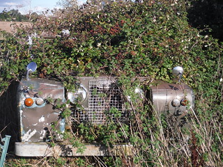
Land Rover in Prime Condition, Barns Farm, Aston Abbotts
SWC Walk 194 Aylesbury Vale Parkway to Aylesbury
Oct-16 • thomasgrabow on Flickr
swcwalks swcwalk194 walkicon 29792388050

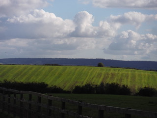
Chilterns out to Ivinghoe Beacon, from field above Rowsham
SWC Walk 194 Aylesbury Vale Parkway to Aylesbury
Oct-16 • thomasgrabow on Flickr
swcwalks swcwalk194 walkicon 29972670072

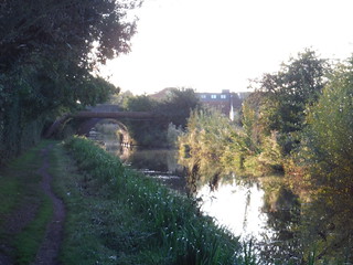
Bridge on Fringes of Aylesbury crossing Grand Union Canal
SWC Walk 194 Aylesbury Vale Parkway to Aylesbury
Oct-16 • thomasgrabow on Flickr
swcwalks swcwalk194 walkicon 30003489911
| Length |
25.9 km (16.1 mi), with 263/262m ascent/descent. For a shorter walk see below Walk Options. |
|---|---|
| Toughness |
5 out of 10, with 5 1/2 hours walking time. For the whole outing, including trains, sights and meals, allow at least 8 hours and 15 minutes. |
| Walk Notes |
This walk links up a few quiet hilltop villages north of Aylesbury in the rolling landscape of East Buckinghamshire, providing for good views into the Aylesbury Vale and back to the Chiltern Range.
Note:
|
| Walk Options |
It is possible to shorten the walk in two ways. Shortcuts I and II are mutually exclusive though:
Several useful bus stops are passed en route (check the route map for their exact location):
|
| Maps |
OS Explorer: 181 (Chiltern Hills North) and 192 (Buckingham & Milton Keynes)
|
| Travel |
Aylesbury Vale Parkway station, map reference SP 786 153, is 3.6 km northwest of Aylesbury and 75m above sea level. Aylesbury Station, map reference SP 817 134, is 76m above sea level. Both are in Buckinghamshire. Aylesbury and Aylesbury Vale Parkway (AVP) stations are on the London Marylebone to Aylesbury line (via Amersham). Journey times are 66 minutes to AVP (hourly service) and from 60 minutes returning from Aylesbury (half-hourly service). Buy a day return to Aylesbury Vale Parkway. Saturday Walkers’ Club: Take the train closest to 9.30 hours. |
| Lunch |
The Five Elms Stockaway, Weedon, Buckinghamshire, HP22 4NL (01296 641 439). The Five Elms is located 5.3 km (3.3 mi) into the walk. It is a 400 years old thatched Freehouse.
|
| Tea |
A plethora of options in Aylesbury City Centre (see Walk Directions pdf), recommended is:
|
| Profile | |
|---|---|
| Help Us! |
After the walk, please leave a comment, it really helps. Thanks! You can also upload photos to the SWC Group on Flickr (upload your photos) and videos to Youtube. This walk's tags are: |
| By Train |
Out (not a train station) Back (not a train station) |
| By Car |
Start Map Directions Return to the start: Finish Map Directions Travel to the start: |
| Amazon | |
| Help |
National Rail: 03457 48 49 50 • Traveline (bus times): 0871 200 22 33 (12p/min) • TFL (London) : 0343 222 1234 |
| Version |
May-22 Thomas G |
| Copyright | © Saturday Walkers Club. All Rights Reserved. No commercial use. No copying. No derivatives. Free with attribution for one time non-commercial use only. www.walkingclub.org.uk/site/license.shtml |
Walk Directions
Full directions for this walk are in a PDF file (link above) which you can print, or download on to a Kindle, tablet, or smartphone.
This is just the introduction. This walk's detailed directions are in a PDF available from wwww.walkingclub.org.uk
