| Berkshire |
|
260 |
Aldermaston to Woolhampton via Frilsham |
22.9 |
6 |
425 |
West Berkshire Downs: ancient woodlands, commons, pretty villages, historical pubs, chalk streams, water meadows, heathland, finishes via landscaped park or the Kennet canal. |
P |
| Berkshire |
|
117 |
Aldermaston to Woolhampton via Stanford Dingley |
20.4 |
4 |
300 |
Quiet and scenic West Berkshire Downs: woodlands, fields, commons, chalk stream valleys, heathland, finish along a canal or through parkland. |
P |
| West Sussex |
|
39 |
Amberley to Pulborough |
25.7 |
7 |
525 |
South Downs Way up a ridge, across a couple of hills, down through hanging woods. Then through the West Weald and the Rother Valley with heathery commons. |
CJ EC V |
| Bedfordshire |
|
233 |
Arlesey to Letchworth Garden City |
25.4 |
4 |
175 |
Achalk stream, the Greensand Ridge, the ‘Cathedral of the Chilterns’, a motte-and-bailey and abandoned medieval village, the Icknield Way past a lavender farm to a Garden City. |
KX |
| West Sussex |
|
217 |
Arundel to Midhurst via Midhurst Way |
31.8 |
8 |
775 |
Long walk though a remote and less visited part of the South Downs National Park |
CJ EC V |
| Buckinghamshire |
|
194 |
Aylesbury Vale Parkway to Aylesbury |
25.9 |
5 |
225 |
Quiet hill top villages in eastern Aylesbury Vale. Finishing with a long stretch along the Grand Union Canal. |
M |
| Peak District |
|
302 |
Bamford to Edale via Win Hill and Great Ridge |
20.3 |
7 |
1,050 |
Tremendous views after steep ascent to Win Hill, then the Great Ridge on the boundary between the Dark and White Peak |
TL E KX StP |
| Yorkshire Dales |
|
436 |
Baugh Fell |
19.8 |
8 |
550 |
Remote hill in wild countryside with fine views. Some rough and pathless ground. Return via Ure Force (waterfall). |
|
| London |
|
46 |
Beckenham Place Park |
4.9 |
1 |
75 |
Attractive park in SE London by the Ravensbourne River, famous for its bluebells, wet woodland, wild swimming lake, ornamental gardens and Palladian mansion |
TL StP |
| Berkshire |
|
399 |
Bedwyn Circular via Savernake Forest and Marlborough |
31 |
7 |
425 |
More veteran trees than anywhere else in Europe, undulating pastures, historic Marlborough and the landscaped Tottenham Park |
P |
| Essex |
|
258 |
Benfleet Circular via Canvey Island |
23.2 |
2 |
75 |
Varied walk around a unique island in the Thames Estuary: mudflats, creeks, river traffic, sandy beaches, seawall murals, grassy marshland, oil terminals & refineries |
FS LS Str |
| Surrey |
★
|
184 |
Bentley to Farnham |
26 |
6 |
450 |
Alice Holt Ancient Forest, Surrey Hills, Scotch Pine Forest, and remote heather filled heathland, Frensham Great and Little Ponds (swimming) |
W |
| Brecon Beacons |
|
86 |
Black Mountain from Glyntawe |
14.6 |
6 |
1,225 |
A strenuous start then easy route finding along a glacial ridge through wild upland scenery to one of the highest peaks in the Brecon Beacons National Park with spectacular views. |
|
| London |
|
421 |
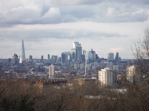
Blackheath to Deptford |
22.2 |
4 |
275 |
Genteel streets, grand houses, a large heathland with views, well-kept parks, a Victorian cemetery and green hills with magnificent views |
CX CS V |
| Brecon Beacons |
|
372 |
Blorenge from Abergavenny |
19.6 |
7 |
1,000 |
Initial brutal ascent then gentle contours along a tramroad, past ruins of the industrial past to Blorenge's upland plateau. Fantastic views of Usk Valley and Black Mountains |
|
| Brecon Beacons |
★
|
278 |
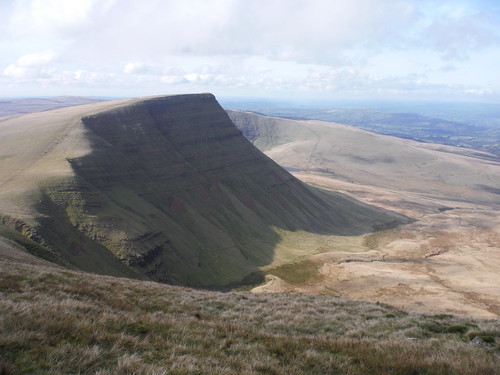
Brecon Beacons Horseshoe from Neuadd Reservoir |
15.3 |
6 |
800 |
A classic horseshoe walk of the Brecon Beacons (Pen y Fan, Corn Du, Fan y Big) around a glacial valley, with an extension to Waun Rydd |
|
| Brecon Beacons |
|
306 |
Brecon Circular via Y Gaer Battle and Pen Y Crug |
18.1 |
5 |
600 |
Lowland walk along rivers, via a Roman Fort and a low ridge to an ancient hill fort |
|
| London |
|
39 |
Brockwell Park |
3.9 |
1 |
50 |
Short amble through a small but well-kept urban park in South East London on raised ground |
TL StP V |
| Hertfordshire |
|
168 |
Broxbourne Circular |
24.3 |
5 |
300 |
Along the New River and up through the Spital Brook valley into Broxbourne Woods National Nature Reserve and an assortment of ancient, diverse and wild woods. |
LS Str |
| Somerset |
|
284 |
Bruton Circular or from Castle Cary |
25.1 |
7 |
700 |
Narrow steep-sided valleys with fast flowing streams and rivers, rolling hilltops, Alfred’s Tower, Hauser & Wirth Somerset art gallery |
P |
| Somerset |
|
342 |
Bruton Circular via Stourhead |
22.7 |
6 |
575 |
Through quiet South Somerset pastures and across a wooded ridge past Alfred's Tower folly and through the beautifully landscaped Stourhead Estate |
P |
| London |
|
59 |
Burgess Park |
7.1 |
1 |
25 |
The Grand Surrey Canal and a succession of parks and open spaces in gritty inner southeast London |
|
| Peak District |
|
385 |
Buxton Circular or to Monsal Dale |
26 |
8 |
1,175 |
A very scenic White Peak dale: tight gorges, limestone crags, steeping stones, cascades, mills. Elevated pastures back to Buxton. Or on to Monsal Head with its famous vistas |
|
| Peak District |
|
387 |
Buxton Circular via Axe Edge Moor and Three Shires Head |
27.1 |
8 |
1,000 |
The vast Axe Edge Moor, the heads of 5 famous Peak District rivers, the popular and scenic Three Shires Head pools and waterfalls, disused quarries and some fine far views |
|
| Peak District |
|
384 |
Buxton Circular via Combs Moss |
16.2 |
5 |
850 |
Exciting but short and easy circuit of a quiet moorland plateau above Buxton. Green valleys, reservoirs, Castle Naze hillfort, far views and dramatic gritstone edges. |
|
| Peak District |
|
386 |
Buxton Circular via the Dragon's Back |
26.1 |
8 |
800 |
Remote and quiet Upper Dove Valley, combining extreme natural beauty with the more esoteric beauty of industrial sites. Go over or past the very unique Dragon's Back |
|
| Peak District |
|
389 |
Buxton to Macclesfield via the Cat and Fiddle |
24.9 |
8 |
800 |
From Spa Town to Silk Town via the wild Goyt Valley, Shining Tor, lonely moorlands down the Clough Brook Valley to Macclesfield Forest and through Tegg's Nose Country Park |
|
| Brecon Beacons |
|
308 |
Bwlch Circular via Mynydd Troed and Llangors Lake |
21.6 |
7 |
900 |
Via an easily accessible glacial ridge to the largest natural lake in South Wales and an ancient hillfort |
|
| Somerset |
|
392 |
Castle Cary Circular via Camelot |
30.3 |
8 |
775 |
Along the fringes of the Somerset Levels over some fine viewpoints to three magnificent hills, one maybe the mythical Camelot of King Arthur fame |
P |
| Buckinghamshire |
|
195 |
Cheddington to Leighton Buzzard |
24.8 |
4 |
200 |
Delightful hill top villages in East Bucks. Panoramic views of The Chilterns and into Aylesbury Vale. |
E |
| London |
|
58 |
Chingford Circular |
7.6 |
1 |
200 |
Varied undulating route through commons, ancient woods and wildflower meadows, with fantastic views of London Skyline and Lea Valley. |
LS |
| Peak District |
|
6 |
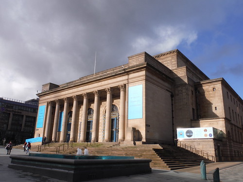
City of Sheffield |
8 |
2 |
125 |
Victorian industrial heritage on the edge of the Peak District |
|
| London |
|
68 |
City of Westminster Gaslights |
12.5 |
1 |
100 |
Enchanting, meandering route through the Royal Parks and the West End under the warm glow of gaslights. Through parks, squares & courtyards, along alleyways, secret passages, lanes, paths & streets. |
|
| Brecon Beacons |
|
370 |
Crickhowell Circular via Mynydd Llangatwg and Craig y Cilau |
18.9 |
6 |
950 |
Llangattock Escarpment with surreal slag heaps, quarries and cliffs, optional caving and a raised bog. Then lush pastures along the Usk Valley with Black Mountains views. |
|
| Brecon Beacons |
|
333 |
Crickhowell Circular via Table Mountain and the three Pens |
20.4 |
8 |
1,125 |
Table Mountain and an airy ridge walk in the Black Mountains across three tops with a scenic descent. |
|
| Merseyside |
|
35 |
Crosby Beach - Antony Gormley's Another Place |
5.1 |
1 |
25 |
Easy beach walk past Antony Gormley's public art installation “Another Place” with views of The Wirral Peninsula. |
|
| Cumbria |
|
414 |
Cross Fell and Great Dun Fell |
33 |
10 |
1,075 |
Exhilarating route along the North Pennines Ridge, over the highest hills in England outside of the Lake District |
|
| London |
|
33 |
Dagenham Parks, Rivers and Ponds |
10.1 |
1 |
25 |
Exploration of several linked green areas in an otherwise densely populated suburb: a large variety of landscapes in Country Parks and Nature Reserves |
|
| Hampshire |
|
265 |
Dean to Mottisfont |
27.7 |
7 |
450 |
Remote West Hampshire chalk downlands: varied Woodlands, the scenic valleys of the Wallop Brook and the Dun and Test Rivers and Broughton Down Nature Reserve |
W |
| Dorset |
|
275 |
Dorchester Circular or to Portesham |
24.3 |
6 |
525 |
Pre-historic landscape of the Dorset Downs with splendid views out to the Jurassic Coast from the South Dorset Ridgeway. Longer extension to the Valley of (Sarsen) Stones |
CJ W |
| Peak District |
|
326 |
Dovedale |
20 |
6 |
900 |
Through a pastoral landscape to the Peak District's most famous and scenic dale with its ravines, crags, pinnacles, arches and caves |
|
| West Sussex |
|
27 |
East Grinstead to Wivelsfield or Sheffield Park |
31.9 |
8 |
575 |
Long walk through area of bluebell-rich woodland then heathery commons, or shorter walk and return by steam train |
CJ EC V |
| Peak District |
|
303 |
Edale Circular via Kinder Scout and Mam Tor |
20.6 |
7 |
1,350 |
Rugged moorlands and dramatically sculpted gritstone outcrops, the lush Vale of Edale and grand views into the Hope Valley from Mam Tor |
|
| Cambridgeshire |
|
118 |
Ely Circular |
18 |
2 |
50 |
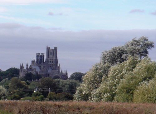
An easy walk through open Fenland, The River Great Ouse, 'big' skies, tree-lined farm tracks, historic Ely Cathedral and a quayside stroll at the end |
KX |
| London |
|
259 |
Manor Park to Epping |
24.2 |
5 |
375 |
A walk along the length of an ancient royal forest in East London - Wanstead and Leyton Flats, Walthamstow Forest, Highams Park and Epping Forest. Can be done over two legs. |
LS |
| Essex |
|
276 |
Epping to Ingatestone via Chipping Ongar |
26.9 |
4 |
250 |
The Essex Way and the St. Peter's Way through mildly undulating landscape with plenty of woodlands and historical buildings. |
|
| Worcestershire |
|
323 |
Evesham to Pershore via Dumbleton and Bredon Hills |
34.3 |
8 |
625 |
Through the Vale of Evesham and over Cotswold Outliers with grand views of the Cotswolds and Malvern Hills |
P |
| Peak District |
|
350 |
Fairholmes Circular |
27.8 |
8 |
675 |
From a remote bus stop onto one of England’s few great, untamed wildernesses: Bleaklow. Descend either across moors and Derwent River's Head, or Westend Valley. |
|
| Hampshire |
★
|
160 |
Farnham to Blackwater |
23 |
4 |
375 |
Farnham Park, Caesar’s Camp Iron Age Hillfort site, Beacon Hill, Bourley Reservoirs, Gelvert Stream, Fleet Pond, Foxlease Meadows and Hawley Common |
CJ W |
| Brecon Beacons |
|
307 |
Craig Y Nos to Llwyn Y Celyn |
21.5 |
8 |
1,000 |
Remote mountain traverse: limestone scenery, Fan Gyhirych, a glacial escarpment, great views all around. Bus travel. |
|
| Bedfordshire |
|
231 |
Flitwick Circular |
25 |
4 |
275 |
Tranquil Flit River, wooded fringes of Flitwick Moor, quiet villages, the De Grey Mausoleum, Wrest House and Gardens, the Greensand Ridge (views), and the heart of Flitwick Moor. |
EC LB |
| Yorkshire Dales |
|
442 |
Fountains Fell and Catrigg Force |
24.4 |
7 |
725 |
Easy exploration of a wild and remote fell. Return with views of green valleys, Malham Tarn and Catrigg Force waterfall. Finish along elevated path above Ribblesdale |
|
| London |
|
67 |
Fulham to Chiswick |
6.6 |
1 |
50 |
Scenic stretch of the Thames Path through Fulham and Hammersmith to Fuller's Griffin Brewery, with loads of refreshment options, grand views and modern and historic buildings. |
|
| Yorkshire Dales |
|
437 |
Great Knoutberry Hill |
18.2 |
6 |
625 |
Easy mountain walk from England's highest station onto grassy hill with fine views. Passes three railway viaducts and uses good track across Blea Moor. |
|
| Peak District |
|
322 |
Grindleford Circular via Chatsworth House |
24.8 |
7 |
600 |
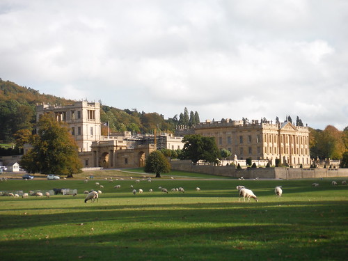
Through ancient woods and along some famous Dark Peak Edges to the UK's most-loved Country House, back through the verdant Derwent Valley |
StP |
| Buckinghamshire |
|
191 |
Haddenham Circular via Brill |
27.7 |
7 |
475 |
Strenuous walk linking several hill top villages in the rolling landscape of the north westerly Aylesbury Vale, with splendid views throughout. |
M |
| Buckinghamshire |
|
193 |
Haddenham to Aylesbury via Gibraltar and Ford |
23.4 |
3 |
150 |
The scenic heart of Aylesbury Vale: picturesque hamlets in the Thame Valley, Notley Abbey, Dinton Hall and Hartwell House. |
M |
| Buckinghamshire |
|
192 |
Haddenham to Aylesbury via Waddesdon |
25.3 |
5 |
300 |
Tranquil stretches of the Thame Valley, combined with a few energetic climbs and long passages through two magnificent Rothschild estates. |
M |
| Cumbria |
|
413 |
Hadrian's Wall Path Core Section |
54 |
10 |
950 |
The most scenic and feature-heavy central section of Hadrian's Wall described as day walks from train stations or bus stops |
|
| West Sussex |
|
239 |
Halnaker to Chichester via Goodwood |
22.9 |
6 |
475 |
Scenic steep chalk downlands around the Upper Lavant Valley, the Goodwood Estate and unrivalled views from St. Roche's Hill |
CJ EC V |
| Bedfordshire |
|
230 |
Harlington to Flitwick |
24.6 |
5 |
325 |
Sundon Hills, the Sharpenhoe Clappers, a Neolithic hill fort, hill top lunch pub in Pulloxhill, and Flitwick ancient woodland. |
StP |
| London |
|
40 |
Harrow on the Hill |
5 |
1 |
150 |
The playing fields of Harrow School and the historic buildings of Harrow village on its ridge |
|
| Surrey |
|
377 |
Haslemere Outer Orbital Path |
26.8 |
8 |
725 |
Orbital route around Haslemere from a rural bus stop, but with plenty of options for connecting routes from the station |
CJ W |
| Surrey |
|
144 |
Haslemere to Farnham |
23.6 |
6 |
550 |
A wooded ridge, Temple of the Four Winds, Gibbet Hill, Devil's Punch Bowl, Highcomb Bottom, Thursley & Hankley Commons, Atlantic Wall, River Wey, Waverley Abbey's ruins |
CJ W |
| West Sussex |
|
48 |
Haslemere to Midhurst via Lurgashall |
21.7 |
6 |
525 |
Black Down and the Temple of the Winds viewpoint, pretty Lurgashall, Cowdray Estate with its romantic ruin and the historic market town of Midhurst. |
CJ W |
| West Sussex |
|
218 |
Haslemere to Midhurst via Midhurst Way |
16.3 |
4 |
375 |
Quiet hills and forests, 2 country pubs, and Cowdray Park. |
CJ W |
| Peak District |
|
315 |
Hathersage Circular via Bretton Clough and Eyam |
22.2 |
7 |
925 |
Rolling hills, drystone walls, deep wooded valleys,the Hope Valley, Eyam and Hucklow ridges, mining industrial heritage, Eyam, peat bogs (on a good path) |
TL E KX StP |
| Peak District |
|
319 |
Hathersage Circular via Stanage Edge Higger Tor and Padley Gorge |
20 |
6 |
575 |
Dark Peak Highlights - up a green valley to Stanage Edge, over Higger Tor and Carl Wark hill forts and down the narrow wooded Padley Gorge, then along the Derwent River |
TL E KX StP |
| Peak District |
|
360 |
Hathersage to Bamford |
25 |
8 |
825 |
Upper Derwent Valley walk out to Ladybower: griststone edges, moors with pre-historic features, overlooked by Stanage Edge, valleys and pastures with views |
TL E KX StP |
| Brecon Beacons |
|
280 |
Henrhyd Waterfalls from Craig y Nos |
13.4 |
3 |
625 |
Rewarding walk through Craig y Nos Country Park and above the Tawe River or via the Cribarth limestone plateau, then up a scenic wooded gorge to South Wales' highest waterfall |
|
| Cumbria |
|
415 |
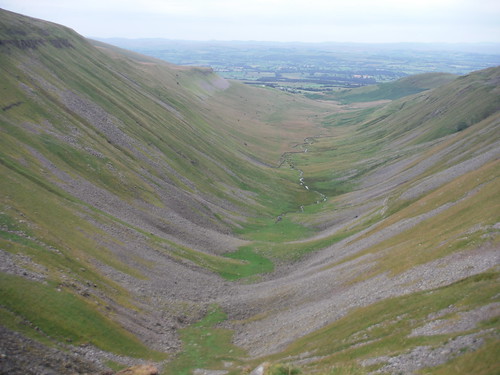
High Cup Nick |
23.9 |
8 |
750 |
One of the finest natural features in northern England, the spectacular High Cup Nick, on good paths and with easy route finding |
|
| London |
|
49 |
Highgate Wood and Queen's Wood |
5.5 |
1 |
150 |
Meandering route through two adjacent ancient woods with very different character. Undulating. |
|
| Hertfordshire |
|
234 |
Hitchin Circular |
25.6 |
6 |
375 |
Across the most north easterly Chilterns ridge to Pegsdon Hills and Knocking Hoe NNR. A motte-and-double bailey and an abandoned medieval village and the Oughton chalk river |
KX |
| Peak District |
|
343 |
Hope to Hathersage or Bamford |
27 |
8 |
925 |
Pastures with views, Mam Tor's landslip area, Cave Dale, lunch in Castleton, Hope Cement Works, a large upland moor and a scenic descent to the Derwent River |
|
| London |
|
57 |
Illuminated River |
9.3 |
1 |
100 |
A Central London evening stroll all about 14 lit Thames Bridges |
|
| Essex |
|
158 |
Ingatestone to Battlesbridge |
24.8 |
4 |
250 |
The Wid Valley and the Wid itself, Hanningfield Reservoir Nature Reserve and the Crouch Valley via a mix of woods and fields. |
LS Str |
| Yorkshire Dales |
|
439 |
Ingleborough via Ingleton |
24.3 |
8 |
825 |
Demanding walk across the fearsome Ingleborough and down to the tourist hotspot Ingleton. Return via fascinating limestone plateau. Waterfalls Route Option |
|
| Yorkshire Dales |
|
440 |
Ingleborough via Moughton Scars and Gaping Gill |
20.7 |
7 |
700 |
Easy route over Yorkshire's finest via the limestone paradise that is its easterly end: limestone pavement, caves, a dramatic gorge and chasm, a pot with the longest waterfall, views |
|
| Essex |
|
216 |
Kelvedon Circular |
23.2 |
4 |
175 |
Gentle Essex walk through the quiet Blackwater Valley to historic Coggeshall, with 300 listed buildings, for lunch. |
LS Str |
| Gloucestershire |
|
256 |
Kemble Circular via Thames Head and Cirencester |
27.8 |
5 |
225 |
Past the Thames Head and along a disused canal, then up through woods to the Severn/Thames watershed and back through the magnificent Cirencester Park and Town |
P |
| Peak District |
|
304 |
Kinder Scout Circuit from Edale |
27 |
9 |
800 |
Strenuous circuit of the Kinder Scout moorland plateau from Edale Station |
|
| Peak District |
|
349 |
Ladybower Inn Circular via Alport Castles and Derwent Reservoirs |
26.9 |
8 |
1,225 |
A grassy ridge to Britain’s longest inland landslip. Descend to skirt the famous Derwent Reservoirs. Hilly return options across moors or along edges. |
|
| Peak District |
|
348 |
Ladybower Inn Circular via Derwent Edge and Strines |
25.8 |
8 |
1,150 |
Famous gritstone formations on Derwent Edge high above the Derwent Reservoirs, wooded Bradfield Dale with its reservoirs and folly tower. Back across moorland to Ladybower. |
|
| Essex |
|
114 |
Laindon Circular |
20.9 |
5 |
325 |
Essex Hills, wooded Nature Reserves and panoramic Thames Valley Views |
FS LS Str |
| Bedfordshire |
|
229 |
Leagrave to Harlington |
23.1 |
4 |
325 |
Meadows, solitary North Chiltern hills, ancient woodlands, steep chalk escarpments, 2 Neolithic hill forts, Barton Hills (chalk downs), and the hill top village of Harlington. |
EC LB |
| Yorkshire Dales |
|
7 |
Leeds City Centre |
9 |
2 |
100 |
Varied route through the centre of the 'Capital of the North' |
|
| London |
|
43 |
Lesnes Abbey Woods with Bostall Woods |
5.2 |
1 |
150 |
Ornamental Gardens, Ancient Woodlands, Ponds and Heathland, centred on the enchanting ruins of Lesnes Abbey. Undulating. |
LB V |
| Bedfordshire |
|
232 |
Lidlington to Flitwick |
22.1 |
5 |
325 |
Marston Vale, the Greensand Ridge, mixed woods and open parkland, heathland, historic Ampthill, ruin of Houghton House, a narrow path through the heart of Flitwick Moor. |
TL E StP |
| Brecon Beacons |
|
332 |
Llangynidr to Bwlch or Circular |
21.9 |
7 |
1,125 |
Up a tight valley to the Chartist Cave in the limestone uplands of Mynydd Llangynidr, return along the rim of the Crawnon Valley. |
|
| Brecon Beacons |
|
347 |
Llanvihangel Crucorney Circular via Bryn Arw and The Skirrid |
20.5 |
7 |
1,025 |
Two easily accessible ridge walks south east of the Black Mountains, quiet pastures with views and a Michelin-starred lunch pub |
|
| London |
|
172 |
Rainham to Purfleet via RSPB Rainham Marshes |
12.7 |
0 |
75 |
An easy birdwatching walk in Outer East London along an atmospheric section of the London LOOP via the RSPB reserve at Rainham marshes. |
FS |
| Dorset |
★
|
54 |
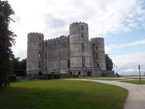
Lulworth Cove Circular |
22.7 |
8 |
1,050 |
Dramatic coastal scenery, Lulworth cove, hidden beaches, Durdle Door cliff arch, and a ghost town. |
CJ W |
| Peak District |
|
382 |
Macclesfield Circular via Teggs Nose and Kerridge Hill |
24.7 |
8 |
1,125 |
Tegg’s Nose Country Park, Macclesfield Forest, the Dean Valley, Lamaload Reservoir, Kerridge Ridge with its picturesque folly, the White Nancy |
E |
| Peak District |
|
381 |
Macclesfield Circular via The Dane Valley |
28.9 |
8 |
1,000 |
The Dane Valley, pastures and wooded valleys, and ridges with views of the Cheshire Plain, high moors and gritstone ridges |
E |
| Peak District |
|
383 |
Macclesfield to Buxton |
25 |
8 |
975 |
Tegg's Nose Country Park, Macclesfield Forest, lonely moorlands up to Shining Tor, and the wild Upper Goyt Valley to the historic Spa Town |
E |
| Peak District |
|
380 |
Macclesfield to Leek |
27.7 |
9 |
1,200 |
Reservoirs, Macclesfield Forest, the 'Cheshire Matterhorn', lonely Wildboarclough, the Dane Valley, Lud's Church chasm and the Roaches gritstone escarpment |
E |
| Dorset |
|
402 |
Maiden Newton Circular or to Dorchester |
28.3 |
8 |
750 |
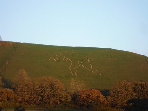
Chalk streams, pretty valleys, rounded hills and broad ridges in the Dorset Downs. Cerne Abbas village with Britain's largest hill figure. |
CJ W |
| Worcestershire |
|
324 |
Malvern Hills from Great Malvern or Colwall |
20.6 |
8 |
1,525 |
Route over the iconic Malverns Range, rising out of the Plain, with optional routes covering all but a few of the tops. |
P |
| Wiltshire |
|
354 |
Marlborough Circular via Avebury |
24.2 |
5 |
325 |
Over the Marlborough Downs and through sarsen fields to the Avebury World Heritage Site |
P |
| London |
|
38 |
Morden Park |
5 |
1 |
50 |
|
TL W |
| Hampshire |
|
58 |
Mottisfont to Romsey |
22.6 |
4 |
300 |
Mottisfont Abbey Gardens, West Hampshire Chalk Downs, Dun & Test Valleys and the picturesque market town of Romsey |
W |
| Cumbria |
|
416 |
Nine Standards |
18.1 |
6 |
600 |
Up to iconic landmark cairns with supreme views then through short peat bog and around the scenic Dukerdale, or along upland watershed above Mallerstang Valley to Garsdale |
|
| Essex |
|
162 |
North Fambridge to Burnham-on-Crouch |
20.9 |
2 |
100 |
Follow the tidal River Crouch eastwards towards the North Sea atop the sea wall. Wide open and scenic countryside, mudflats, creeks, rich bird life, sailing boats and marinas. |
LS |
| London |
|
41 |
Nunhead, Honor Oak, and Peckham Rye |
8 |
1 |
125 |
Nunhead's Victorian Cemetery, assorted green spaces, One Tree Hill with its viewpoint, Peckham Rye Park and Common, and its culturally mixed centre. |
TL LB V |
| London |
|
27 |
Olympic Park, Hackney Wick and Fish Island |
8.5 |
1 |
100 |
The Olympic Park, waterways, wetlands, and former industrial areas |
|
| London |
|
50 |
Osterley Park |
10.4 |
1 |
75 |
Osterley Park, Tentelow Woodland, Grand Junction Canal, Hanwell Flight of Locks, River Brent, a riverside meadow and the stunning Wharncliffe Viaduct. |
|
| London |
|
44 |
Oxleas Wood and Shooter’s Hill |
6.3 |
1 |
150 |
Through ancient woodlands up to Shooter's Hill with far views across the south east, on to Severndroog Castle Folly |
LB V |
| Brecon Beacons |
|
335 |
Pandy Inn to Llanvihangel Crucorney |
24.7 |
8 |
1,000 |
Offa's Dyke Path along Hatterrall Hill and Ridge, return through the Vale of Ewyas past Llanthony Priory and the Leaning Church in Cwmyoy |
|
| Oxfordshire |
|
170 |
Pangbourne via Goring Circular |
16 |
2 |
225 |
Part-wooded ridges above the Thames Valley to lunch in Goring, shorter return along the Thames through meadows |
P |
| Brecon Beacons |
|
85 |
Pen Y Fan and Corn Du from Storey Arms |
7.6 |
3 |
550 |
A classic, and very popular, short walk climbing up to the two highest peaks in the Brecon Beacons along an engineered path. |
|
| Yorkshire Dales |
|
441 |
Pen-y-ghent and Plover Hill |
17.2 |
5 |
575 |
The iconic Pen-y-ghent via a quiet ascent route, then the even quieter Plover Hill. Return through remote countryside on good paths. Fine views all round. |
|
| Wiltshire |
|
127 |
Pewsey Circular |
27 |
6 |
400 |
North Wessex Downs and the Vale of Pewsey |
P |
| Wiltshire |
|
255 |
Pewsey Circular via Avebury |
36.6 |
8 |
575 |
Long walk over Wiltshire downs to Avebury World Heritage Site |
P |
| West Sussex |
|
294 |
Pulborough to Halfway Bridge via Tillington |
26 |
7 |
575 |
The Rother and Lod valleys, Littleworth and Sutton Common heathlands, South Downs views, Burton Park and three good pubs |
CJ EC V |
| London |
|
54 |
Rotherhithe |
7.3 |
1 |
75 |
Parks and waterways on the Rotherhithe peninsula |
|
| West Sussex |
|
68 |
Rowlands Castle Circular |
25.6 |
7 |
500 |
A walk, first through park- and woodland, then through some remote westerly valleys of the South Downs. At its best in spring for plentiful bluebells and wild garlic. |
CJ W |
| Hertfordshire |
|
164 |
Roydon to Sawbridgeworth |
22.7 |
3 |
225 |
Open countryside with wheat fields, woods and waterways; stretches of the River Ash in the morning and the Stort Navigation near the end. Passes Henry Moore Foundation. |
LS Str |
| Kent |
|
154 |
Rye, Dungeness and Lydd-on-Sea |
21.8 |
3 |
75 |
Interesting coastal walk past an extra wide beach framed by sand dunes and an army range to an eerie shingle desert landscape with decommissioned nuclear power stations. Return by bus. |
LB StP |
| Wiltshire |
|
254 |
Salisbury Circular |
32.2 |
7 |
450 |
Gentle start via historic Salisbury, the Chalke Valley, pretty villages. Strenuous afternoon via the Downs, a Roman Road, and a noted Water Meadows view of the Cathedral |
CJ W |
| Wiltshire |
|
67 |
Salisbury to Amesbury via Old Sarum and Stonehenge |
26 |
5 |
325 |
Up the Avon Valley from the attractive marker town of Salisbury past Old Sarum hillfort and castle site to the Stonehenge World Heritage Site and on to historic Amesbury |
CJ W |
| Hertfordshire |
|
210 |
Sawbridgeworth to Bishops Stortford |
23.8 |
4 |
275 |
Sawbridgeworth, gently rolling countryside, fields, woods and waterways, the Stort Navigation, and Bishop's Stortford |
LS Str |
| London |
|
24 |
Sculpture in the City |
2.7 |
1 |
75 |
Walk around an annual summer exhibition of contemporary sculpture in the confines of the City of London (financial district). |
|
| Yorkshire Dales |
|
443 |
Settle Circular via Malham |
22.8 |
7 |
800 |
From a pretty market town through impressive limestone scenery to the natural wonders of Malham: cove, waterfall, dramatic gorge, dry valleys, a stream out of caves, a very large tarn |
|
| Peak District |
|
267 |
Sheffield Circular via Porter and Gleadless |
27.8 |
8 |
775 |
Strenuous excursion through the south westerly wooded valleys of Sheffield |
|
| Peak District |
|
266 |
Sheffield to Bamford via Stanage Edge |
25.6 |
7 |
650 |
From Sheffield's urban centre through narrow valleys and across wild moorland to the Dark Peak's gritstone edges, and a lush finish into the Hope Valley |
|
| Essex |
|
159 |
South Woodham Ferrers to North Fambridge |
25.7 |
5 |
275 |
Varied walk out of the Crouch valley through undulating parts of Essex with a serene riverside finish, passing RHS Garden Hyde Hall, some woods and vineyards. |
LS |
| Hertfordshire |
|
165 |
St Margarets Circular |
24.1 |
4 |
275 |
Quiet rolling Hertfordshire countryside, a haunted, ruined church and long stretches in scenic river valleys. |
LS |
| London |
|
56 |
Stanmore Circular |
8.7 |
1 |
225 |
Undulating route through various parks, commons and nature reserves in leafy North London, including the London Viewpoint |
|
| Brecon Beacons |
|
401 |
Storey Arms to Libanus or Circular via Ystradfellte |
30 |
10 |
950 |
Strenuous route in the Fforest Fawr: 4 peaks, upland moor, limestone plateaus, and a glorious descent into the Usk Valley. Stretches of pathless terrain |
|
| Brecon Beacons |
|
334 |
Sugar Loaf Circular from Abergavenny |
19 |
6 |
775 |
Ascent of the iconic Sugar Loaf along quiet paths: lush pastures, ancient oak woods, grassy ridges, heather and gorse. Tea at a vineyard. |
|
| Kent |
|
299 |
Teynham to Faversham |
24.7 |
3 |
125 |
Fruit farms, Saxon Shore Way along tidal River Swale, creeks, mudflats, and the stark but beautiful landscape of windswept grazing marshes. Oare Marshes. Historic Faversham. |
V |
| Oxfordshire |
|
190 |
Thame Circular |
20.9 |
2 |
100 |
Scenic ramble through quiet villages in the Thame Valley on the Oxon/Bucks border, north of the Chilterns. |
M |
| London |
|
42 |
Thames Path : Greenwich to Woolwich |
11 |
1 |
100 |
A Fascinating Stretch of The Thames: Maritime Greenwich, Greenwich Peninsula, Charlton, Thames Barrier, Royal Woolwich Arsenal |
|
| Brecon Beacons |
|
279 |
The Black Mountain from Glyntawe |
21.9 |
8 |
1,600 |
A spectacular ridge walk to Fan Brycheiniog, Fan Foel and Waun Lefrith. Return via a glacial valley below the ridge, or remote moorland, shakeholes and a waterfall |
|
| Brecon Beacons |
|
371 |
The Clydach Gorge |
17.9 |
4 |
750 |
Wild and dramatic Clydach Gorge: waterfalls, cascades, fast-flowing waters, ancient beechwoods as well as an ironworks' ruins and an elevated railway line |
|
| London |
|
34 |
The Ingrebourne Valley : Hornchurch to Upminster |
11.7 |
1 |
50 |
Open water, grassland, woodland, marshland, fenland via a series of linked green spaces along the Ingrebourne River |
|
| London |
|
21 |
The Line Modern Art Walk |
8.3 |
1 |
100 |
A modern and contemporary art walk via foot, light rail and cable car |
|
| London |
|
47 |
The London Wall |
4.7 |
1 |
75 |
What have the Romans ever done for us? Through the City of London past all publicly accessible pieces of the Roman Wall and its city gates |
|
| London |
|
62 |
The River Beck |
9.5 |
1 |
125 |
Rural start through West Wickham, then down the River Beck Corridor through woodlands and parks to Beckenham's busy Town Centre |
CX CS |
| Wiltshire |
|
250 |
Tisbury Circular via Alvediston |
26 |
7 |
700 |
An Iron Age hill fort, pretty coombes, and plenty ascent: the Vale of Wardour and West Wiltshire Downs AONB with views to the Cranborne Chase and all the way to the coast |
CJ W |
| Wiltshire |
|
249 |
Tisbury Circular via Dinton and Fovant |
24.1 |
6 |
475 |
The Nadder Valley, Dinton Park, undulating countryside of the West Wiltshire Downs, with views to distant coombes, and the regimental Fovant Badges (large hill side figures) |
CJ W |
| Wiltshire |
|
252 |
Tisbury Circular via Donhead St. Andrew |
23.3 |
7 |
500 |
The Vale of Wardour in the Wiltshire Downs AONB. Wardour Park, Nadder Head, a neolithic hill fort, Barkers hill, Old Wardour Castle. Long and shorter version. |
CJ W |
| Wiltshire |
|
248 |
Tisbury Circular via Hindon |
22 |
5 |
425 |
The Nadder Valley, picturesque villages, some dry chalky U-shaped downs of the West Wiltshire Downs, wooded ridges and one of Britain’s largest thatched buildings |
CJ W |
| Wiltshire |
|
251 |
Tisbury Circular via Ludwell |
26.4 |
7 |
575 |
The Upper Nadder Valley (Wiltshire Downs), Wardour Park and its ruined Castle, steep ascents to Win Green and White Sheet hills and Chalke Valley. |
CJ W |
| London |
|
66 |
Turkey Street |
10.2 |
1 |
125 |
London’s first Beaver Enclosure, several scenic waterways, a park and some fine woods as well as some impressive country estates open to the public |
LS |
| East Sussex |
|
262 |
Uckfield to Buxted |
21.6 |
4 |
300 |
Uck Valley, undulating Low Weald Countryside, van Hoogstraten's path, Blackboys Inn, Tickerage Stream valley with Vivien Leigh's home, and Buxted Park |
EC LB |
| Peak District |
|
388 |
Upper Hulme to Macclesfield via Hen Cloud, Roaches, Shutlingsloe |
24.9 |
8 |
1,175 |
Hen Cloud and the Roaches, the Hanging Stone, Lud's Church chasm, the Dane Valley, lonely Wildboarclough, the 'Cheshire Matterhorn', Macclesfield Forest, Reservoirs. |
|
| London |
|
65 |
Walthamstow |
4.6 |
1 |
75 |
Along residential streets to Lloyd Park (William Morris Gallery) and the Old Village, then plenty of food and drink options. Longer option with woods and commons. |
|
| Brecon Beacons |
|
400 |
Waterfall Country |
22.4 |
8 |
950 |
More rapids, cascades and waterfalls than any other walk, wooded gorges, limestone uplands, caves, mines and far views |
|
| London |
|
36 |
Waterlink Way : Lower Sydenham to Greenwich |
9.7 |
1 |
25 |
Follows the Pool and Ravensbourne rivers through south east London via landscaped linear parks and green spaces |
CX LB |
| Essex |
|
116 |
Wendens Ambo Circular |
23.7 |
4 |
225 |
North West Essex hills and pretty villages |
LS |
| Buckinghamshire |
|
140 |
Wendover Circular via The Lee and Swan Bottom |
20.1 |
5 |
450 |
Along the Ridgeway through the Chiltern Hills and through many splendid woodlands, a conservation village and idyllic Lee Common |
M |
| Wiltshire |
|
286 |
Westbury to Warminster via Imber Range |
30.3 |
8 |
775 |
Westbury White Horse, 5 hills (3 of which Iron Age Camps), pristine chalk downland on Salisbury Plain, an abandoned village on the rarely open Imber Range |
P |
| Yorkshire Dales |
|
438 |
Whernside |
20.7 |
6 |
625 |
Onto Yorkshire's highest point along quiet back-of-the-hill route. Return through the limestone country of Chapel-le-Dale. |
|
| Essex |
|
157 |
Wickford to Battlesbridge |
21 |
3 |
200 |
Grassy fields, quiet lanes, a smattering of woods, Hanningfield Reservoir Nature Reserve and the tidal River Crouch. |
LS Str |
| Cumbria |
|
417 |
Wild Boar Fell |
23.3 |
7 |
700 |
Remote ridge walk above the Mallerstang Valley with Howgill Fells views, via Swarth Fell to Wild Boar Fell and down into the Upper Eden Valley |
|
| London |
|
26 |
Woodberry Wetlands |
6.9 |
1 |
50 |
Finsbury and Clissold Parks, Woodberry Wetlands (two reservoirs), The New River (a canal supplying water to London) and Abney Park (a Magnificent 7 Cemetery) |
|
| Dorset |
|
346 |
Wool Circular |
30.9 |
9 |
1,025 |
Thomas Hardy Country, pretty coombes, the Jurassic Coast (Durdle Door, Stair Hole and Lulworth Cove), Lulworth Park with its fantastic Castle, and Coombe Heath |
CJ W |
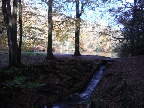
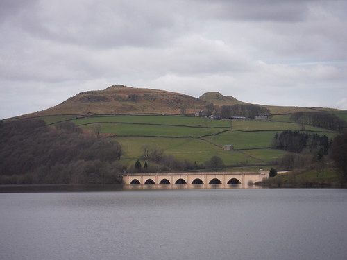
![St. Matthews, Midgham SWC Walk 260 Aldermaston to Woolhampton [Midgham Station] (via Frilsham)](https://live.staticflickr.com/1567/25672359333_46902017c7.jpg)




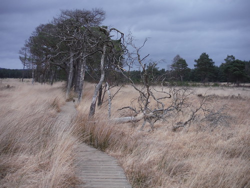
![Cathedral Oak, Savernake Forest SWC 399 - Bedwyn Circular (via Savernake Forest and Marlborough) [Young Paunchy and Cathedral Oak Loop]](https://live.staticflickr.com/65535/52421348591_e7c6906dc1.jpg)






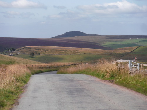
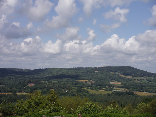
![Castle Naze from road up to walk route from The Beehive Inn SWC 384 - Buxton Circular via Combs Moss [Descent to the Beehive Inn]](https://live.staticflickr.com/65535/51596558365_d3a7839176.jpg)





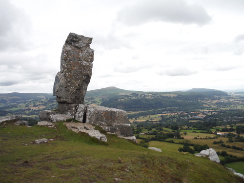
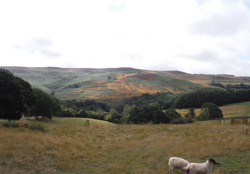
![Table Mountain/Crug Hywel from road before final descent SWC Walk 333 - Crickhowell Circular (via Table Mountain and the Three Pens) [Road Ending]](https://live.staticflickr.com/65535/32736114627_ebb4f49dc9.jpg)






















![Along the Skirrid ridge SWC Walk 347 - Llanvihangel Crucorney Circular (via Bryn Arw and The Skirrid) [taken by Jenny P]](https://live.staticflickr.com/65535/51535297666_8352f700c8.jpg)





![Thames Valley Upstream, from Hartslock Nature Reserve SWC Walk 170 Pangbourne Circular via Goring-on-Thames [Hartslock Nature Reserve Extension]](https://live.staticflickr.com/65535/50536680932_e0bf1cfa23.jpg)




![Large Reclining Figure (1984) [II] SWC Walk 164 Roydon to Sawbridgeworth via Henry Moore Foundation](https://live.staticflickr.com/576/21051709342_682e63efd9.jpg)










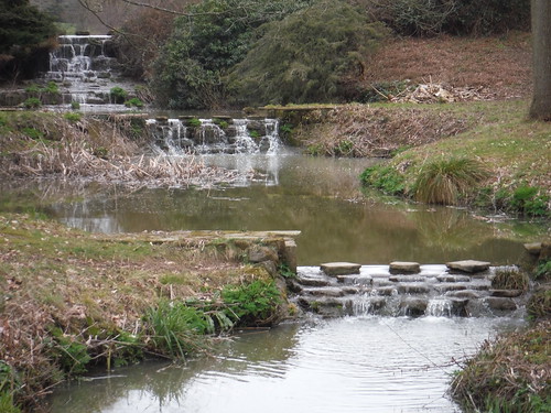


![Picnic spot on Wicken Water, Arkesden SWC Walk 116 Wendens Ambo [Audley End station] Circular](https://live.staticflickr.com/1637/24981197719_1648060bdb.jpg)
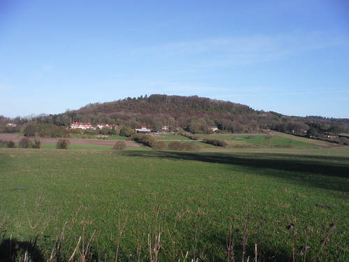
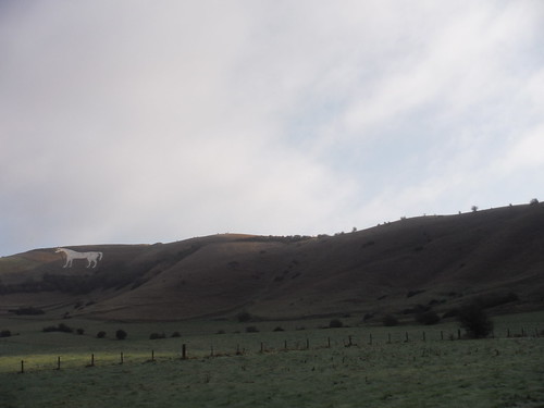

![Backview from Mark's Farm towards Rettendon SWC Walk 157 - Wickford to Battlesbridge or South Woodham Ferrers [Battlesbridge Ending]](https://live.staticflickr.com/65535/49945388907_9e031bb2c1.jpg)


