Angel to Limehouse Short Walk
The Regents canal, Victoria and Mile End Parks

Islington to Limehouse
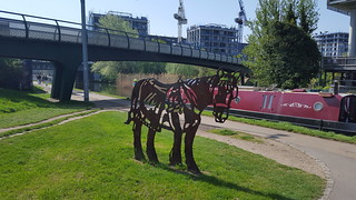
swcwalks short29 walkicon regentscanal mileend london 40729863595

Islington to Limehouse
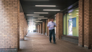
swcwalks short29 islington regentscanal london 26753205977


photo
Aug-19 • hikinginlondon on Flickr
angeltolimehousewalk angel limehouse walk mileendparks victoria theregentscanal east london swcwalks short29 hiking 48536239481

photo
Aug-19 • hikinginlondon on Flickr
angeltolimehousewalk angel limehouse walk mileendparks victoria theregentscanal east london swcwalks short29 hiking 48536784836
| Start | Angel Tube Ticket Hall entrance |
|---|---|
| Finish | Limehouse Docklands Light Railway |
| Length | 7 miles / 11.5 km |
| Time | 2.5 to 3 hours |
| Travel | Angel is on the London Underground Northern Line and many bus routes. Limehouse is on the DLR. You'll meed an Oyster/Travelcard for Zone 1 and 2 |
| Walk Notes |
A canal side walk through North and East London. This is a simple walk, (keep the canal on the right apart for the Victoria Park extension) and ideal for mid-summer evenings. Allow 2.5 to 3 hours to do the full walk or about 2 hours to leave the walk at Mile End |
| Eat | Restaurants in West India Key, The Ledger (J.D. Wetherspoons) |
| Profile | |
|---|---|
| Help Us! |
After the walk, please leave a comment, it really helps. Thanks! You can also upload photos to the SWC Group on Flickr (upload your photos) and videos to Youtube. This walk's tags are: |
| By Car |
Start Map Directions Finish Map Directions |
| Amazon | |
| Help |
National Rail: 03457 48 49 50 • Traveline (bus times): 0871 200 22 33 (12p/min) • TFL (London) : 0343 222 1234 |
| Version |
Oct-23 Mike A |
| Copyright | © Saturday Walkers Club. All Rights Reserved. No commercial use. No copying. No derivatives. Free with attribution for one time non-commercial use only. www.walkingclub.org.uk/site/license.shtml |
Walk Directions
Full directions for this walk are in a PDF file (link above) which you can print, or download on to a Kindle, tablet, or smartphone.
This is just the introduction. This walk's detailed directions are in a PDF available from wwww.walkingclub.org.uk
A canal side walk through North and East London. This is a simple walk, (keep the canal on the right apart for the Victoria Park extension) and ideal for mid-summer evenings or days when it might be problematic to leave London on Public Transport. .
Allow 2½ to 3 hours to do the full walk or about 2 hours to leave the walk at Mile End
Directions
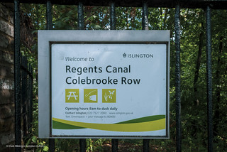
Leave the Angel tube Station ticket hall by the north facing side entrance with the RBS bank on your right and proceed along Islington High Street for about 200 metres to The York pub. Turn right down Duncan Street here. In 150 metres cross Duncan Terrace (where the New River used to flow), Then cross Colebrook Row using the pedestrian crossing and immediately pass between two brick pillars to join the Regents Canal towpath as the Canal emerges from the tunnel under Islington.
The walk starts with the Hanging gardens of Islington through the ever changing vistas of North and East London. Google maps have captured a "Canal View" for the first part of the walk if you want a taster.
After about 5 km the towpath kisses the edge of Victoria Park. The walk leaves the canal here to enter the Park.
Pass through Canal Gate and walk along the boundary avenue initially in a northeasterly and then a southeasterly direction. Ignore all ways off and in about 700 metres exit the park at the Royal Gate and cross Grove road at a pedestrian crossing . Enter the eastern section of the park through the large gates to the right of the Royal Inn on the Park and continue in the same direction down the broad avenue in the park.
After 700 metres at an avenue junction with the The People’s Park Tavern ahead, turn 5 sharp right 5 metres before the junction on to a narrow path. Pass the bowling club grounds on the left and in a further 60 metres where the path converges with another path, cross this path and turn slightly left to enter the Old English Garden continuing in the same direction. Emerge from the gardens after about 150 metres and head towards the pond 20 metres ahead. Turn left here to walk alongside the pond for 40 metres and then continue in the same direction merging with another path after a further 70 metres. In 200 metres cross the park’s main avenue to head for the Lock House Gate and in 10 metres turn right through an open gate following a path to the Hertford Union Canal towpath. Continue in the same direction (240°) for 500 metres (initially alongside the park then under Old Ford Road followed by Victorian houses and two high rise blocks on your right). Leave the canal here by ascending steps to Grove Road and cross the pedestrian crossing. The Crown Pub on the right offers options for a thirst quencher.
Turn left to continue the walk passing a parking area for a local Gym on the right and crossing Wennington Road. Enter Wennington Green and take the diagonal path, and in 150 metres bear slightly right then left on a grassy bank to rejoin the Regents Canal. If Wennington Green is shut, simply walk down Wennington Road and continue in the same direction on the track at the end of the road. This track curves to the left to rejoin the towpath
The route through Victoria Park

If you are intending to leave the walk at Mile End, you may wish to visit the quirky Palm Tree pub 200 metres along the towpath and to your left.
After a further 300 metres the canal approaches Mile End Lock. Leave the canal towpath here branching left on a footpath towards the Guardian Angels Church.
If you wish to leave the walk here, you may catch a District or Central Line tube at Mile End Station 200 metres away. To do this, you will need to bear left off the main path and head for the bus turnaround point. Turn right here and at the road junction cross Grove Road towards the Subway takeaway and then cross Mile End Road, Turn left to find the Tube station entrance in about 50 metres.
Otherwise continue by climbing the path which traverses Mile End Road via the Green Bridge ( complete with trees and flora) extending the Mile End Park over the busy A11 trunk road. As the path descends, rejoin the towpath.
The towpath continues passing the Ragged School Museum and in a further 200 metres passes an unusually tall brick built chimney which despite its classic Victorian design simply once served as a sewer vent.
In 2km the towpath reaches Limehouse Basin and the Thames. Here you may turn right to cross the canal on a metal footbridge, continuing for 100 metres to catch a DLR from Limehouse station.
Coda
This is quite a long evening walk, but walkers who wish to go the extra mile (actually about 800 metres) are encouraged to continue to Docklands. There are stunning night views of the Thames, the City of London and Docklands skylines on this additional section.
Proceed as follows: Climb the steps to the left of the footbridge and join Basin Approach continuing in the same direction. In 120 metres at the Limehouse Gallery & Bronze Age studios, turn right down a path next to a river basin. Follow the path as it turns left and then turn right across a footbridge to enter the park at Ropemakers field. Continue in the same direction until you reach Narrow Street. Turn left here and in a few metres turn right at Dunbar Wharf on a path which crosses a basin on a footbridge. Follow the Thames to the Promenade at Canary Wharf. Here you may catch a Thames Clipper
To continue to Canary Wharf Stations (DLR and Jubilee tube Line), climb the steps to the left at the Promenade and cross Westferry Circus roundabout continuing on West India Avenue. Take the right fork at Cabot Square and look for the signs for the DLR station. The DLR is above the road and traverses it north/south. To catch a Jubilee line tube, walk under the DLR bridge and in 60 metres turn right to continue down some steps where you will see the entrance to the Canary Wharf tube station to your left.
Eateries
If you wish to eat, take the left fork at Cabot Square and follow the road round to the right. In 25 metres turn left on a broad paved area and descend to the North Dock Footbridge. Cross the footbridge to find a selection of restaurants ahead. There is also a J.D. Wetherspoon’s Pub The Ledger 150 metres to your left
About this Document
This document is sourced and managed in Google Docs where it may be collaboratively edited. Google Docs maintains a full version history of changes and authors which can be viewed in File -> Version History
This source Document can be downloaded in html, PDF, epub, Markdown and many other formats
Google Docs also supports uploading and importing of doc, docx and odt documents and, to some extent, PDF documents and provides for data inheritance.
If you wish to contribute to this document, you will need a gmail account.
Log into your gmail account and browse to the Source Document at the URL below.
Click on the blue view only button at the top left and then the request edit access button
Google Docs also supports a javascript based script editor to extend the capabilities of any Google Document and allows authors to introduce Document metadata into the document itself
Metadata
Last edited on Friday 12 July 2019 at 11:56
Source URL is https://docs.google.com/open?id=1CWWGO5LPUxHIyXpRyVDJ1LPN38XM7mfQyFLSHZSBYgk

