City of Sheffield City Walk
Victorian industrial heritage on the edge of the Peak District
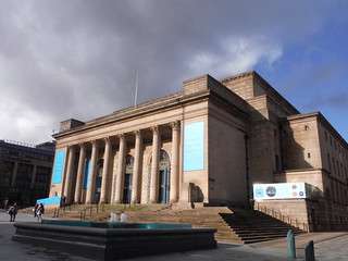
City Hall, Barker's Pool
SWC City Walk 6 - City of Sheffield
Feb-22 • thomasgrabow on Flickr
walkicon swcwalks city6 51921726934

Niche Building, Sidney Street
SWC City Walk 6 - City of Sheffield
Feb-22 • thomasgrabow on Flickr
walkicon swcwalks city6 51921489198

Upriver view to Lady's Bridge, from Castlegate
SWC City Walk 6 - City of Sheffield
Feb-22 • thomasgrabow on Flickr
walkicon swcwalks city6 51921726334

Kelham Island Museum across mill race
SWC City Walk 6 - City of Sheffield
Feb-22 • thomasgrabow on Flickr
walkicon swcwalks city6 51921394426

Cutting Edge and Sheaf Square Cascades
SWC City Walk 6 - City of Sheffield
Feb-22 • thomasgrabow on Flickr
swcwalks city6 51921726194
| Length |
8.0 km (5.0 mi), with 144/146m cumulative ascent/descent. For a shorter or longer walk, see below Walk Options. |
|---|---|
| Toughness |
2 out of 10, with 1 ¾ hours walking time. |
| Walk Notes |
This route leads through the centre of Sheffield – the self-proclaimed ‘Steel City’. It is the largest city in South Yorkshire, known both for its history at the heart of a steel and cutlery-based industrialisation and for being one of the greenest cities in the country, right on the fringes of – and partly in – the Peak District.
|
| Walk Options |
Bus and Tram stops are never far from the route to enable shorter walks.
|
| Maps | OS Explorer: 278 (Sheffield & Barnsley)
OS Landranger: 110 (Sheffield & Huddersfield) |
| Transport |
Sheffield (Midland) station, map reference SK 359 870, is 227 km north north west of Charing Cross and 54m above sea level. Shalesmoor Tram Stop, map reference SK 348 881, is 1.5 km north west of Midland Station and 52m above sea level. Both are in South Yorkshire. Sheffield (Midland) Station is the terminus of the Midland Main Line from London St. Pancras, with up to two trains per hour (journey time from 121 mins Mondays-Saturdays, longer on Sundays). Shalesmoor Tram Stop is served by the Blue and Yellow Lines. Both lines travel through the City Centre as far as the Fitzalan Square/Ponds Forge stop. The Blue Line (direction Halfway) continues to also stop at the train station. Single tickets (£1.90 fare in 02/22) can be purchased onboard, in cash or by card. |
| Food and Drink |
Numerous options are passed on or just off the route. They are highlighted in the text. |
| Profile | |
|---|---|
| Help Us! |
After the walk, please leave a comment, it really helps. Thanks! You can also upload photos to the SWC Group on Flickr (upload your photos) and videos to Youtube. This walk's tags are: |
| By Train |
Out (not a train station) Back (not a train station) |
| By Car |
Start Map Directions Finish Map Directions |
| Amazon | |
| Help |
National Rail: 03457 48 49 50 • Traveline (bus times): 0871 200 22 33 (12p/min) • TFL (London) : 0343 222 1234 |
| Version |
May-22 Thomas G |
| Copyright | © Saturday Walkers Club. All Rights Reserved. No commercial use. No copying. No derivatives. Free with attribution for one time non-commercial use only. www.walkingclub.org.uk/site/license.shtml |

Walk Directions
Full directions for this walk are in a PDF file (link above) which you can print, or download on to a Kindle, tablet, or smartphone.
This is just the introduction. This walk's detailed directions are in a PDF available from wwww.walkingclub.org.uk