The Ingrebourne Valley : Hornchurch to Upminster Short Walk

Open water, grassland, woodland, marshland, fenland via a series of linked green spaces along the Ingrebourne River
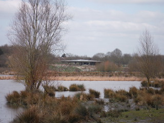
Ingrebourne Valley Visitor Centre and Ingrebourne Marshes SSSI SWC Short Walk 34 - The Ingrebourne Valley (Hornchurch to Upminster)
Ingrebourne Valley Visitor Centre and Ingrebourne Marshes SSSI

SWC Short Walk 34 - The Ingrebourne Valley (Hornchurch to Upminster)

Mar-18 • thomasgrabow on Flickr

swcwalks short34 banner 27057822178

Up Ingrebourne Hill SWC Short Walk 34 - The Ingrebourne Valley (Hornchurch to Upminster)
Up Ingrebourne Hill

SWC Short Walk 34 - The Ingrebourne Valley (Hornchurch to Upminster)

Mar-18 • thomasgrabow on Flickr

swcwalks short34 walkicon 40887142722

Ingrebourne Marshes SSSI SWC Short Walk 34 - The Ingrebourne Valley (Hornchurch to Upminster)
Ingrebourne Marshes SSSI

SWC Short Walk 34 - The Ingrebourne Valley (Hornchurch to Upminster)

Mar-18 • thomasgrabow on Flickr

swcwalks short34 walkicon 40929081121
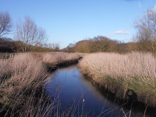
Ingrebourne River SWC Short Walk 34 - The Ingrebourne Valley (Hornchurch to Upminster)
Ingrebourne River

SWC Short Walk 34 - The Ingrebourne Valley (Hornchurch to Upminster)

Mar-18 • thomasgrabow on Flickr

swcwalks short34 walkicon 27057574278
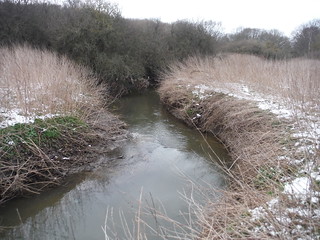
Ingrebourne River SWC Short Walk 34 - The Ingrebourne Valley (Hornchurch to Upminster)
Ingrebourne River

SWC Short Walk 34 - The Ingrebourne Valley (Hornchurch to Upminster)

Mar-18 • thomasgrabow on Flickr

swcwalks short34 40035184015

Length

11.7 km/7.3 mi Ascent: 90m Time: 2 1/2 hours

Walk Notes

The part of the Ingrebourne Valley walked through on this walk comprises a varied and unique mixture of interlinked and partly overlapping local green spaces - Ingrebourne Valley Greenway, Berwick Glades, Berwick Woods, Hornchurch Country Park, Ingrebourne Hill and the Sutton, Hacton and Gaynes Parkways. These include habitats ranging from river, open water, grassland, secondary and ancient woodland, marshland, fenland (with the largest continuous area of freshwater reed beds in Greater London), and – not to forget – some arable farmland.

Partly former airfield, ex-quarries, farmland or landfill site, it is now a continuous green space and contains – pound for pound – one of the best viewpoints of London's Skyline, from all of 11 metres above sea!

Walk Options
  • Several shortcuts are possible, as the southerly parts of the outbound and return routes are running close to each other, these are obvious on the route map.
  • Bus Stops for services to District Line stations are located close to the route after 8 km and 9.2 km.
  • Follow the outbound route back to Hornchurch station instead of going to Upminster: cut 1.8 km.
  • An Extension through Berwick Woods to the reed-fringed Berwick Pond adds 1.4 km.
  • An Alternative Ending at Rainham station links up with the start of SWC 172 - Rainham to Purfleet (via RSPB Rainham Marshes); Hornchurch to Rainham is a 7.2 km/4.5 mi walk.
Eat

Ingrebourne Valley Visitor Centre Hornchurch Country Park, off Suttons Lane, Hornchurch RM12 6DF (01708 520 364). Open every day 09.00-17.00 (-16.00 Nov-Jan). The visitor centre is located 3.9 km from the end of the walk.
Several pubs, cafés, bistros and restaurants in Upminster. See the pdf for details.

Refreshments in Rainham:
The Albion Rainham Road, Rainham, Essex RM13 8SS (01708 552 445). A Flaming Grill pub, tied to Greene King.
The Phoenix Broadway, Rainham, Essex RM13 9YW (01708 552 445). A Craft Union pub, open all day and right by the station.

Notes

Ingrebourne River/Ingrebourne Valley Local Nature Reserve
The River Ingrebourne /ˈɪŋɡərˌbɔːrn/ is a 43 km (27 mi) tributary of the River Thames. It rises near Brentwood, Essex, from where it flows in a southwesterly direction under the M25 and through the Borough of Havering roughly from north to south, joining the Thames at Rainham.
Ingrebourne Valley is a 146ha local nature reserve. It is owned and managed by Havering Council, and has a visitor centre managed by the Essex Wildlife Trust. Most of it is in Hornchurch Country Park west of the River Ingrebourne, but there are also areas north and south of the park which are part of the LNR.

Berwick Glades/Berwick Woods
Berwick Glades, owned by the Forestry Commission, is 12ha of former farmland planted in 2003. To maintain the views across the Ingrebourne marshes towards Hornchurch and Elm Park large open glades with wildflower meadows have been left between the new planting, leading to the site name.
Berwick Woods are a 25 ha privately owned woodland (Tarmac Construction) open to the public. It is a restored sand and gravel quarry and was officially opened to the public in 1999.

Hornchurch Country Park
Hornchurch Country Park (120ha) is located on the former site of Hornchurch Airfield. The RAF Hornchurch base was used during both World Wars and squadrons of Spitfires based here played an important role during the Battle of Britain. Various artefacts and relics of the site's RAF history are still visible including an aircraft dispersal bay, pillboxes, and Tett turrets. A designated Local Nature Reserve, the park is an integral part of the Ingrebourne Valley. Some southern parts of the park have been used as landfill. Almost all of it falls within the Ingrebourne Valley LNR, and the eastern edge is part of the Ingrebourne Marshes SSSI.

Ingrebourne Hill
Ingrebourne Hill is a 44ha former sand and gravel quarry, which was filled with a range of materials, including bricks, concrete and metal before a land reclamation and restoration company purchased the site in conjunction with the Forestry Commission and transformed it into a country park.

Ingrebourne Marshes
Ingrebourne Marshes are a 75ha Site of Special Scientific Interest, managed by the Essex Wildlife Trust. The site is the largest area of freshwater marsh in London with the largest freshwater reed bed in London. It has large areas of reed sweet-grass, common reed swamp, wet neutral grassland and tall fen, all with a wide variety of invertebrates and breeding birds. The Marshes run along both sides of the Ingrebourne River, and are almost all closed to the public, but part of it can be viewed from Hornchurch Country Park. A long narrow strip stretches east from the river, incorporating Berwick Pond. This is open to the public.

Saint Laurence, Upminster
A Grade I listed building, it is the historic minster or church from which Upminster derives its name, meaning 'upper church', probably signifying 'church on higher ground'. The place-name is first attested as 'Upmynster' in 1062. The church is a good example of 13th century construction. The tower dates from this period and is rubble-walled, with buttresses at the foot, and a leaded and shingled spire, typical of Essex.

Transport

Hornchurch Underground Station is in Zone 6, on the District Line to Upminster. Journey time from Aldgate East is 36 minutes, from Victoria 53 minutes. You can shave off time by taking mainline trains from Fenchurch Street (or from Limehouse or West Ham) to Upminster and then travel back a couple of stops on the underground. Upminster Station is also in Zone 6 and served by the London, Tilbury and Southend Railway from Fenchurch Street (journey time 22 minutes, via Limehouse, West Ham and Barking), as well as the terminus of the District Line and of the Romford to Upminster Overground.

Profile
Help Us!

After the walk, please leave a comment, it really helps. Thanks!

You can also upload photos to the SWC Group on Flickr (upload your photos) and videos to Youtube. This walk's tags are:

swcwalks
short34
By Car

Start Map Directions

Finish Map Directions

Amazon
Help

National Rail: 03457 48 49 50 • Traveline (bus times): 0871 200 22 33 (12p/min) • TFL (London) : 0343 222 1234

Version

Aug-22 Thomas G

Copyright © Saturday Walkers Club. All Rights Reserved. No commercial use. No copying. No derivatives. Free with attribution for one time non-commercial use only. www.walkingclub.org.uk/site/license.shtml

Walk Directions

Full directions for this walk are in a PDF file (link above) which you can print, or download on to a Kindle, tablet, or smartphone.

This is just the introduction. This walk's detailed directions are in a PDF available from wwww.walkingclub.org.uk