Harlington to Flitwick Walk
Sundon Hills, the Sharpenhoe Clappers, a Neolithic hill fort, hill top lunch pub in Pulloxhill, and Flitwick ancient woodland.

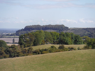
Valley in Sundon Hills
SWC Walk 230 Harlington to Flitwick
Sep-15 • thomasgrabow on Flickr
swcwalks swcwalk230 walkicon banner 21625750188

Sharpenhoe Hillfort Site from Sundon Hills (I)
SWC Walk 230 Harlington to Flitwick
Sep-15 • thomasgrabow on Flickr
walkicon swcwalks swcwalk230 21192583493

Path in Wood on Moleskin Hill (III)
SWC Walk 230 Harlington to Flitwick
Sep-15 • thomasgrabow on Flickr
walkicon swcwalks swcwalk230 21626673119

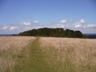
Sharpenhoe Clappers: the path to the Hillfort Site
SWC Walk 230 Harlington to Flitwick
Sep-15 • thomasgrabow on Flickr
walkicon swcwalks swcwalk230 21787355586

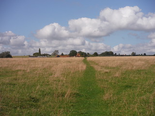
Towards Portobello Farm
SWC Walk 230 Harlington to Flitwick
Sep-15 • thomasgrabow on Flickr
walkicon swcwalks swcwalk230 21801569482
| Length | 24.6 km (15.2 mi), with 264/281m ascent/descent. For a shorter walk see below Walk Options. |
|---|---|
| Toughness | 5 out of 10, with 5 hours walking time. For the whole outing, including trains, sights and meals, allow at least 8 hours. |
| Walk Notes | The central attraction of this North Chiltern walk in Central Bedfordshire are the Sundon Hills, steep rolling downlands affording fantastic views over the surrounding plain, out north to the Greensand Ridge, and east to the classic steep chalk escarpment of Sharpenhoe Clappers, which is passed through as well.
At Sharpenhoe, one of the largest Neolithic hill fort sites in the South East is walked through, with good views east to Barton Hills, followed by a steep descent into the plain below. Further fine views of Pegsdon Hills further east along the Chilterns follow from the route through rolling grassy fields to the quiet hill top lunch destination of Pulloxhill. The afternoon route is less energetic, but not without interest, leading as it does through pastures and woods in the gently rolling plain and lastly through the ancient Flitwick Wood with its large areas of bluebells and wild garlic in season, then into the centre of Flitwick. |
| Walk Options | Two Shortcuts are possible, the one pre-lunch cuts 3.1 km and 58m of ascent/descent, the one post-lunch cuts 2.2 km and 25m of ascent/descent. Using Shortcut II or both of them reduces the rating to 3/10.
An Alternate Ending at Harlington saves 7.3 km (4.5 mi) and 46m/59m of ascent/descent respectively and makes for a circular walk of 17.3 km (10.7 mi) length, again with a 3/10 rating. Bus 200 (Biggleswade – Flitwick) stops at Pulloxhill, opposite the lunch pub (Mon-Sat, 6 buses per day). Bus 42 (Bedford – Dunstable) stops at Westoning, next to The Chequers pub, and connects to Flitwick or Harlington stations (Mon-Sat, 9 buses per day). |
| Maps | OS Explorer: 193 (Luton & Stevenage)
OS Landranger: 153 (Bedford & Huntingdon) and 166 (Luton & Hertford) |
| Travel | Harlington station, map reference TL 034 303, is 56 km North northwest of Charing Cross, 11 km north of Luton and 95m above sea level. Flitwick station, map reference TL 034 349, is 5 km north of Harlington and 78m above sea level. Both are in Central Bedfordshire and on the Thameslink line to Bedford. There are four trains per hour and journey times from St. Pancras to Harlington are 44 or 45 minutes Mon-Sat and from 49 mins on Sundays. Flitwick is one stop further along the line and journey times are 49 or 50 minutes Mon-Sat and from 52 minutes Sundays. Buy a return ticket to Flitwick.
Saturday Walkers’ Club: Take the train closest to 9.30 hours (assuming travel from St. Pancras). |
| Lunch |
The Cross Keys 13 High Street, Pulloxhill, Bedfordshire, MK45 5HB (01525 712 442). The Cross Keys is located 12.2 km (7.6 mi) into the full walk and is a traditional family-friendly pub-restaurant in a 15th century building set in 6 acres of ground, with a garden at the back.
|
| Tea |
Various options near to and at the end in Flitwick and in Harlington. For details see the Walk Directions pdf. |
| Profile | |
|---|---|
| Help Us! |
After the walk, please leave a comment, it really helps. Thanks! You can also upload photos to the SWC Group on Flickr (upload your photos) and videos to Youtube. This walk's tags are: |
| By Train |
Out (not a train station) Back (not a train station) |
| By Car |
Start Map Directions Return to the start: Finish Map Directions Travel to the start: |
| Amazon | |
| Help |
National Rail: 03457 48 49 50 • Traveline (bus times): 0871 200 22 33 (12p/min) • TFL (London) : 0343 222 1234 |
| Version |
Apr-24 Thomas G |
| Copyright | © Saturday Walkers Club. All Rights Reserved. No commercial use. No copying. No derivatives. Free with attribution for one time non-commercial use only. www.walkingclub.org.uk/site/license.shtml |
Walk Directions
Full directions for this walk are in a PDF file (link above) which you can print, or download on to a Kindle, tablet, or smartphone.
This is just the introduction. This walk's detailed directions are in a PDF available from wwww.walkingclub.org.uk
