Leagrave to Harlington Walk
Meadows, solitary North Chiltern hills, ancient woodlands, steep chalk escarpments, 2 Neolithic hill forts, Barton Hills (chalk downs), and the hill top village of Harlington.

Side Valley in Barton Hills
SWC Walk 229 Leagrave to Harlington
Oct-15 • thomasgrabow on Flickr
swcwalks swcwalk229 walkicon banner 21924355060

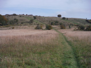
The route up Warden Hill
SWC Walk 229 Leagrave to Harlington
Oct-15 • thomasgrabow on Flickr
walkicon swcwalks swcwalk229 22100142902

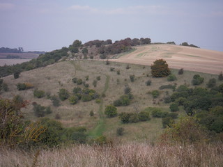
Galley Hill, from Warden Hill (II)
SWC Walk 229 Leagrave to Harlington
Oct-15 • thomasgrabow on Flickr
walkicon swcwalks swcwalk229 21925719189

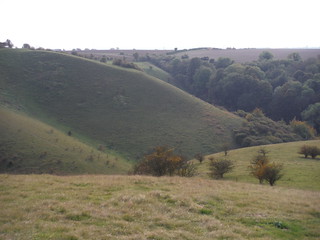
Serrated Down, Barton Hills
SWC Walk 229 Leagrave to Harlington
Oct-15 • thomasgrabow on Flickr
walkicon swcwalks swcwalk229 22099936162

Sharpenhoe Iron Age Hillfort Site, from near Harlington
SWC Walk 229 Leagrave to Harlington
Oct-15 • thomasgrabow on Flickr
walkicon swcwalks swcwalk229 22122371771
| Length | 23.1 km (14.4 mi), with 250/275m ascent/descent. For a shorter walk see below Walk Options. |
|---|---|
| Toughness | 4 out of 10, with 5 hours walking time. For the whole outing, including trains, sights and meals, allow at least 7 hours 45 minutes. |
| Walk Notes |
The start to this walk in Central Bedfordshire with a long urban stretch may sound inauspicious, but most of that leads through meadows along the early beginnings of the River Lea. And the rewards are many and varied: far views from solitary North Chiltern hills, ancient woodlands, steep chalk escarpments, two of the largest Neolithic hill forts in the South East and an exceptionally fine and steep chalk down land: Barton Hills, as good as any other.
|
| Walk Options |
Two – mutually exclusive – pre-lunch shortcuts reduce the length of the walk by 6.6 km and 55m ascent/descent, and by 6.5 km and 85m ascent/descent respectively.
There are several Mon-Sat bus services from opposite the lunch stops in Barton-Le-Clay to Luton, terminating at Galaxy Centre, close to Luton train station, which is closer to London on the same train line. |
| Maps | OS Explorer: 193 (Luton & Stevenage)
OS Landranger: 153 (Bedford & Huntingdon) and 166 (Luton & Hertford) |
| Travel | Leagrave station, map reference TL 061 241, is in a north westerly suburb of Luton, 121m above sea level. Harlington station, map reference TL 034 302, is 11 km north of Luton and 95m above sea level. Both are in Central Bedfordshire. Leagrave and Harlington stations are on the Brighton to Bedford-Thameslink line, stopping at East Croydon, London Bridge (or Elephant & Castle), Blackfriars, City Thameslink, Farringdon, St. Pancras International and West Hampstead Thameslink, with 4 trains per hour. Journey times from St. Pancras to Leagrave are 37 - 40 minutes Mondays to Saturdays, and 43 - 45 minutes Sundays. Harlington is one stop further up the line and journey times are 44 - 49 minutes (4 trains per hour).
Buy a return ticket to Harlington (Bedfordshire).
Saturday Walkers’ Club: Take the train closest to 9.30 hours (assuming travel from St. Pancras). |
| Lunch |
The Raven of Hexton Village Street, Hexton, Hitchin, Hertfordshire, SG5 3JB (01582 881 209). The Raven is located 10.1 km (6.3 mi) into the full walk and is a traditional family-friendly pub-restaurant.
|
| Tea |
The Millhouse Coffee Shop at The Olde Watermill Dickensian Village Barton Mill Lane, off Faldo Road, Barton-le-Clay, Bedford, MK45 4RF (0845 872 0507). The Olde Watermill is located 5.4 km/3.4 mi from the end of the walk.
|
| Profile | |
|---|---|
| Help Us! |
After the walk, please leave a comment, it really helps. Thanks! You can also upload photos to the SWC Group on Flickr (upload your photos) and videos to Youtube. This walk's tags are: |
| By Train |
Out (not a train station) Back (not a train station) |
| By Car |
Start Map Directions Return to the start: Finish Map Directions Travel to the start: |
| Amazon | |
| Help |
National Rail: 03457 48 49 50 • Traveline (bus times): 0871 200 22 33 (12p/min) • TFL (London) : 0343 222 1234 |
| Version |
Sep-24 Thomas G |
| Copyright | © Saturday Walkers Club. All Rights Reserved. No commercial use. No copying. No derivatives. Free with attribution for one time non-commercial use only. www.walkingclub.org.uk/site/license.shtml |
Walk Directions
Full directions for this walk are in a PDF file (link above) which you can print, or download on to a Kindle, tablet, or smartphone.
This is just the introduction. This walk's detailed directions are in a PDF available from wwww.walkingclub.org.uk
